IMAGES TAKEN NEAR TO
Park Road, TREORCHY, CF42 6LD

Introduction

This page details the photographs taken nearby to Park Road, CF42 6LD by members of the Geograph project.

The Geograph project started in 2005 with the aim of publishing, organising and preserving representative images for every square kilometre of Great Britain, Ireland and the Isle of Man.

There are currently over 7.5m images from over14,400 individuals and you can help contribute to the project by visiting https://www.geograph.org.uk

Image Map


Images are licensed for reuse under creativecommons.org/licenses/by-sa/2.0
Notes
  • Clicking on the map will re-center to the selected point.
  • The higher the marker number, the further away the image location is from the centre of the postcode.

Image Listing (70 Images Found)

Images are licensed for reuse under creativecommons.org/licenses/by-sa/2.0
  • ...
Image
Details
Distance
1
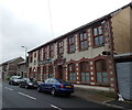
Tanner's Parc Hotel, Cwmparc
The year 1898 in inscribed on the Park Road building.
Image: © Jaggery Taken: 4 Apr 2014
0.01 miles
2
Parc Hotel, Cwmparc
Image: © Roger Cornfoot Taken: 14 Mar 2009
0.02 miles
3
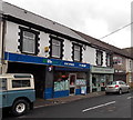
Y Siop in Cwmparc
Welsh for The Shop, Y Siop is a Lifestyle Express convenience store at 226 Park Road. Also in view are Sheppards Pharmacy and The Chippy (traditional fish & chips shop).
Image: © Jaggery Taken: 4 Apr 2014
0.02 miles
4
Down Woodland Terrace, Cwmparc
Woodland Terrace descends towards Y Siop http://www.geograph.org.uk/photo/4072062 in Park Road.
Image: © Jaggery Taken: 4 Apr 2014
0.03 miles
5
Park Road towards Treorchy, Cwmparc
Park Road is the main road through Cwmparc.
Image: © Jaggery Taken: 4 Apr 2014
0.03 miles
6
Children's playground in Cwmparc
Set below the south side of Tallis Street.
Image: © Jaggery Taken: 4 Apr 2014
0.04 miles
7
Playground ahead, Tallis Street, Cwmparc
Tallis Street descends from the Woodland Terrace junction towards the edge of this http://www.geograph.org.uk/photo/4121277 playground.
Image: © Jaggery Taken: 4 Apr 2014
0.05 miles
8
House construction on the site of a demolished chapel in Cwmparc
In April 2014, housing was being built on the site formerly occupied by Bethel English Baptist chapel, erected in 1873.
Image: © Jaggery Taken: 4 Apr 2014
0.05 miles
9
Tallis Street, Cwmparc
The houses in this part of Tallis Street face a children's playground. http://www.geograph.org.uk/photo/4121277
Image: © Jaggery Taken: 4 Apr 2014
0.06 miles
10
Woodland Terrace, Cwmparc
Viewed across Park Road looking up Woodland Terrace towards Tallis Street.
Image: © Jaggery Taken: 4 Apr 2014
0.06 miles
  • ...