
IMAGES TAKEN NEAR TO
Park Road, TREORCHY, CF42 6HU
Introduction
This page details the photographs taken nearby to Park Road, CF42 6HU by members of the Geograph project.
The Geograph project started in 2005 with the aim of publishing, organising and preserving representative images for every square kilometre of Great Britain, Ireland and the Isle of Man.

There are currently over 7.5m images from over14,400 individuals and you can help contribute to the project by visiting https://www.geograph.org.uk
Image Map
Images are licensed for reuse under creativecommons.org/licenses/by-sa/2.0
Notes
- Clicking on the map will re-center to the selected point.
- The higher the marker number, the further away the image location is from the centre of the postcode.
Image Listing (76 Images Found)
Images are licensed for reuse under creativecommons.org/licenses/by-sa/2.0
Image
Details
Distance
1
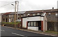
Unnamed shop in Cwmparc
In early April 2014, there was no identifier on this single-storey
building in Park Road, so it was unclear whether or not it was still in use.
UPDATE Chris Bundy states "This used to be a greengrocer called Vid Evans (Evans the greengrocer).
Image: © Jaggery
Taken: 4 Apr 2014
0.01 miles
2
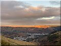
Waiting for Xmas Day
Xmas Eve and the sun has set over Cwmparc and Treorchy, with the last rays of sunlight still casting a red glow on Mynydd Maerdy.
Image: © Alan Hughes
Taken: 24 Dec 2020
0.01 miles
3
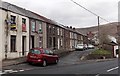
Row of houses above Park Road, Cwmparc
The 55 metre long row of houses is on the north side of Park Road.
The broken white lines on the left are at the junction of Sunnybank Terrace. http://www.geograph.org.uk/photo/4071265
Image: © Jaggery
Taken: 4 Apr 2014
0.01 miles
4
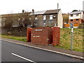
Basic urinal, Park Road, Cwmparc
The brick structure is a basic urinal (no pedestals or wash basins). Though such facilities have largely disappeared from many parts of South Wales, basic urinals (of varying designs) remain a common sight here in the Rhondda.
Image: © Jaggery
Taken: 4 Apr 2014
0.02 miles
5
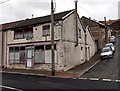
Derelict corner in Cwmparc
The building is on the corner of Sunnybank Terrace and Park Road. The long pipe chimney and a depiction of a fish above the doorway suggest this used to be a fish and chips shop.
UPDATE Thanks to Chris Bundy who told me "This was a fish and chip shop owned by the Latimer family".
Image: © Jaggery
Taken: 4 Apr 2014
0.03 miles
6
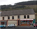
Post office and hairdressers in Cwmparc
Viewed from Sunnybank Terrace. On the left side of the village post office is Cutting It hairdressers.
Image: © Jaggery
Taken: 4 Apr 2014
0.03 miles
7
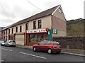
Cwmparc Post Office
At 177 Park Road, Cwmparc.
Image: © Jaggery
Taken: 4 Apr 2014
0.03 miles
8
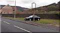
Vacant site alongside Park Road, Cwmparc
The metal frame on top of a concrete post suggests that this may have been the site of a pub.
The village post office http://www.geograph.org.uk/photo/4064575 is on the left.
Image: © Jaggery
Taken: 4 Apr 2014
0.03 miles
9
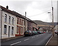
Row of houses in Park Road, Cwmparc
The 50 metre long row of houses ends at Cwmparc post office. http://www.geograph.org.uk/photo/4064575
Image: © Jaggery
Taken: 4 Apr 2014
0.03 miles
10
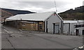
NW corner of Parc & Dare Ex-Servicemen's Club in Cwmparc
On the corner of Sunnybank Terrace and Castle Street.
Image: © Jaggery
Taken: 4 Apr 2014
0.03 miles