IMAGES TAKEN NEAR TO
Treorchy Industrial Estate, TREORCHY, CF42 6EQ

Introduction

This page details the photographs taken nearby to Treorchy Industrial Estate, CF42 6EQ by members of the Geograph project.

The Geograph project started in 2005 with the aim of publishing, organising and preserving representative images for every square kilometre of Great Britain, Ireland and the Isle of Man.

There are currently over 7.5m images from over14,400 individuals and you can help contribute to the project by visiting https://www.geograph.org.uk

Image Map


Images are licensed for reuse under creativecommons.org/licenses/by-sa/2.0
Notes
  • Clicking on the map will re-center to the selected point.
  • The higher the marker number, the further away the image location is from the centre of the postcode.

Image Listing (13 Images Found)

Images are licensed for reuse under creativecommons.org/licenses/by-sa/2.0
Image
Details
Distance
1
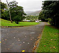
Unnamed road on the north side of Pentwyn Road, Ton Pentre
Descending towards the Rhondda River.
Image: © Jaggery Taken: 8 Oct 2018
0.15 miles
2
Pentre looking towards Treorchi
This is the beautiful view from Catherine Street across Pentre towards Treorchi
Image: © Nick Mutton 01329 000000 Taken: 8 Jul 2007
0.16 miles
3
Bench alongside Pentwyn Road, Ton Pentre
On the north side of the B4223 Pentwyn Road.
Image: © Jaggery Taken: 8 Oct 2018
0.19 miles
4
Ordnance Survey Cut Mark
This OS cut mark can be found behind the wall post of the Alexandra Hotel. It marks a point 153.592m above mean sea level.
Image: © Adrian Dust Taken: 7 May 2017
0.19 miles
5
Ordnance Survey Cut Mark
This OS cut mark can be found on The Griffin PH. It marks a point 157.109m above mean sea level.
Image: © Adrian Dust Taken: 7 May 2017
0.19 miles
6
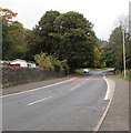
Road from Ton Pentre towards Treorchy
The B4223 Pentwyn Road heads away from Ton Pentre.
Image: © Jaggery Taken: 8 Oct 2018
0.21 miles
7
Ordnance Survey Cut Mark
This worn OS cut mark can be found on No127 Llewellyn Street. It marks a point 164.757m above mean sea level.
Image: © Adrian Dust Taken: 7 May 2017
0.22 miles
8
Pentwyn Road, Ton Pentre
The B4223 Maindy Road is behind the camera. The B4223 Pentwyn Road is ahead.
Image: © Jaggery Taken: 8 Oct 2018
0.22 miles
9
Western Power Distribution line spur pole, Ton Pentre
A rural part of the electricity supply infrastructure on the north side of the B4223.
Image: © Jaggery Taken: 8 Oct 2018
0.22 miles
10
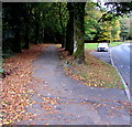
Tree-lined pavement, Pentwyn Road, Ton Pentre
The pavement diverges from the south side of the B4223 Pentwyn Road.
Image: © Jaggery Taken: 8 Oct 2018
0.22 miles