1
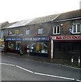
Danish Bacon Deli and Cafe, Treorchy
Two adjacent premises on Bute Street, between Herbert Street and Senghenydd Street, are Danish Bacon Deli (home-cooked meats) and Danish Bacon Cafe.
Image: © Jaggery
Taken: 23 Jan 2012
0.02 miles
2
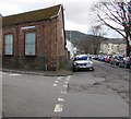
On-street parking, Senghenydd Street, Treorchy
Viewed from the corner of Bute Street looking to the southwest
along Senghenydd Street towards River Terrace and the Rhondda River.
Image: © Jaggery
Taken: 6 Mar 2020
0.03 miles
3
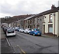
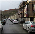
Herbert Street, Treorchy
A typical street in a typical Welsh valleys mining town. The mining has gone but the community and the spirit are still there.
Image: © Alan Hughes
Taken: 10 Sep 2022
0.04 miles
4
Junction of Senghenydd Street and River Terrace, Treorchy
From the left, Senghenydd Street joins River Terrace.
The cars on the right are parked above the Rhondda River.
Image: © Jaggery
Taken: 6 Mar 2020
0.04 miles
5
West along River Terrace, Treorchy
The Rhondda River is below the left edge of the photo.
Image: © Jaggery
Taken: 6 Mar 2020
0.04 miles
6
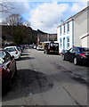
Herbert Street, Treorchy
From Bute Street along Herbert Street towards River Terrace.
Image: © Jaggery
Taken: 14 Mar 2020
0.04 miles
7
Bute Street In The Snow
A view of middle Bute Street, Treorchy during the snow.
Image: © Jordan Evans
Taken: 17 Dec 2010
0.04 miles
8
Ordnance Survey Cut Mark
This OS cut mark can be found on the old Bakery building on Sengenhydd Street. It marks a point 161.828m above mean sea level.
Image: © Adrian Dust
Taken: 28 Apr 2017
0.04 miles
9
Footbridge from Dyfodwg Street to River Terrace, Treorchy
Footbridge https://www.geograph.org.uk/photo/6407721 over the Rhondda River.
Image: © Jaggery
Taken: 6 Mar 2020
0.04 miles
10
Cars, pavement, wall, trees and river, Treorchy
The Rhondda River flows below the wall on the south side of River Terrace.
Image: © Jaggery
Taken: 6 Mar 2020
0.04 miles


