
IMAGES TAKEN NEAR TO
Treherbert Road, TREORCHY, CF42 5SX
Introduction
This page details the photographs taken nearby to Treherbert Road, CF42 5SX by members of the Geograph project.
The Geograph project started in 2005 with the aim of publishing, organising and preserving representative images for every square kilometre of Great Britain, Ireland and the Isle of Man.

There are currently over 7.5m images from over14,400 individuals and you can help contribute to the project by visiting https://www.geograph.org.uk
Image Map
Images are licensed for reuse under creativecommons.org/licenses/by-sa/2.0
Notes
- Clicking on the map will re-center to the selected point.
- The higher the marker number, the further away the image location is from the centre of the postcode.
Image Listing (59 Images Found)
Images are licensed for reuse under creativecommons.org/licenses/by-sa/2.0
Image
Details
Distance
1
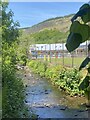
Pen Pych Primary School
View across the Rhondda river.
Image: © Alan Hughes
Taken: 29 May 2023
0.03 miles
2
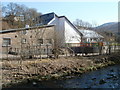
Penpych Primary School, Blaenrhondda
Viewed from a bridge above the Rhondda Fawr river.
Image: © Jaggery
Taken: 23 Mar 2011
0.05 miles
3
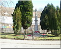
Blaenrhondda War Memorial
The War Memorial is located between the west bank of the Rhondda Fawr river, and Blaenrhondda Road. It is a granite obelisk on a square concrete base, in an enclosure protected by railings.
Behind the memorial, on the east bank of the river, is Penpych Primary School.
Image: © Jaggery
Taken: 23 Mar 2011
0.05 miles
4

Benchmark 10 Clyngwyn Terrace, Blaenrhondda
An Ordnance Survey Cut Mark can be found on 10 Clyngwyn Terrace, Blaenrhondda. It marks a height of 204.676m above mean sea level.
Image: © John Jenkins
Taken: 18 Aug 2025
0.06 miles
5
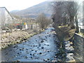
Rhondda Fawr river downstream, Blaenrhondda
The Rhondda Fawr flows away from a bridge connecting Penpych Primary School on the left with Blaenrhondda Road.
Image: © Jaggery
Taken: 23 Mar 2011
0.06 miles
6
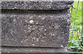
Ordnance Survey Cut Mark
This OS cut mark can be found on the south parapet of St Albans Bridge. It marks a point 203.994m above mean sea level.
Image: © Adrian Dust
Taken: 29 Apr 2017
0.08 miles
7
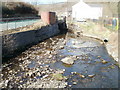
Rhondda Fawr river emerges from under Blaenrhondda Road, Blaenrhondda
About a kilometre from its source, the Rhondda Fawr emerges from underneath a road bridge.
Image: © Jaggery
Taken: 23 Mar 2011
0.10 miles
8
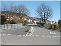
St Alban's Bridge, Blaenrhondda
The view from Blaenrhondda Road along St Alban's Bridge (spanning the Rhondda Fawr river).
The houses in the distance are on St Alban's Road.
Image: © Jaggery
Taken: 23 Mar 2011
0.10 miles
9
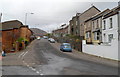
St Alban's Road, Tynewydd
Viewed from the Blaen-y-cwm Road junction.
Image: © Jaggery
Taken: 23 Jan 2012
0.10 miles
10
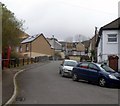
Upper St Alban's Road, Tynewydd
Upper St Alban's Road climbs away from St Alban's Road, past a red phonebox, towards the junction with Halifax Terrace.
Image: © Jaggery
Taken: 23 Jan 2012
0.10 miles