1
Pen Pych Primary School
View across the Rhondda river.
Image: © Alan Hughes
Taken: 29 May 2023
0.08 miles
2
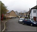
Upper St Alban's Road, Tynewydd
Upper St Alban's Road climbs away from St Alban's Road, past a red phonebox, towards the junction with Halifax Terrace.
Image: © Jaggery
Taken: 23 Jan 2012
0.08 miles
3
St Alban's Road, Tynewydd
Viewed from the Blaen-y-cwm Road junction.
Image: © Jaggery
Taken: 23 Jan 2012
0.08 miles
4
St Alban's Bridge, Blaenrhondda
The view from Blaenrhondda Road along St Alban's Bridge (spanning the Rhondda Fawr river).
The houses in the distance are on St Alban's Road.
Image: © Jaggery
Taken: 23 Mar 2011
0.08 miles
5
Ordnance Survey Cut Mark
This OS cut mark can be found on the south parapet of St Albans Bridge. It marks a point 203.994m above mean sea level.
Image: © Adrian Dust
Taken: 29 Apr 2017
0.10 miles
6
Ordnance Survey Cut Mark
This OS cut mark can be found on No4 Coldra Road. It marks a point 236.577m above mean sea level.
Image: © Adrian Dust
Taken: 9 Nov 2020
0.10 miles
7
Rhondda Fawr river downstream, Blaenrhondda
The Rhondda Fawr flows away from a bridge connecting Penpych Primary School on the left with Blaenrhondda Road.
Image: © Jaggery
Taken: 23 Mar 2011
0.10 miles
8
Penpych Primary School, Blaenrhondda
Viewed from a bridge above the Rhondda Fawr river.
Image: © Jaggery
Taken: 23 Mar 2011
0.12 miles
9
Blaenrhondda War Memorial
The War Memorial is located between the west bank of the Rhondda Fawr river, and Blaenrhondda Road. It is a granite obelisk on a square concrete base, in an enclosure protected by railings.
Behind the memorial, on the east bank of the river, is Penpych Primary School.
Image: © Jaggery
Taken: 23 Mar 2011
0.12 miles
10
Disused (?) Church in St Albans Terrace, Tynewydd
Image: © John Lord
Taken: 10 Sep 2008
0.12 miles


