
IMAGES TAKEN NEAR TO
Dumfries Street, TREORCHY, CF42 5PP
Introduction
This page details the photographs taken nearby to Dumfries Street, CF42 5PP by members of the Geograph project.
The Geograph project started in 2005 with the aim of publishing, organising and preserving representative images for every square kilometre of Great Britain, Ireland and the Isle of Man.

There are currently over 7.5m images from over14,400 individuals and you can help contribute to the project by visiting https://www.geograph.org.uk
Image Map
Images are licensed for reuse under creativecommons.org/licenses/by-sa/2.0
Notes
- Clicking on the map will re-center to the selected point.
- The higher the marker number, the further away the image location is from the centre of the postcode.
Image Listing (243 Images Found)
Images are licensed for reuse under creativecommons.org/licenses/by-sa/2.0
Image
Details
Distance
1
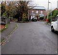
House above Dumfries Street, Treherbert
At the end of an unnamed street extending for 40 metres from Dumfries Street.
Image: © Jaggery
Taken: 26 Oct 2017
0.03 miles
2
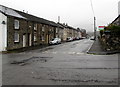
Dumfries Street from Stuart Street, Treherbert
Looking to the WNW along Dumfries Street.
Image: © Jaggery
Taken: 26 Oct 2017
0.03 miles
3
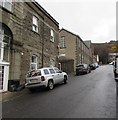
Unnamed side street in Treherbert
Ascending from Bute Street towards Dumfries Street.
Image: © Jaggery
Taken: 9 Nov 2017
0.03 miles
4
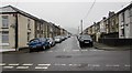
Dumfries Street towards Stuart Street, Treherbert
Dumfries Street crosses Church Street. Stuart Street is in the distance.
Image: © Jaggery
Taken: 26 Oct 2017
0.03 miles
5
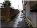
Back lane in Treherbert
Between the backs of buildings in Dumfries Street on the left and Abertonllwyd Street on the right.
Image: © Jaggery
Taken: 26 Oct 2017
0.04 miles
6
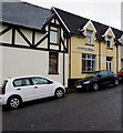
Trinity Gospel Hall, Treherbert
Located in Stuart Street near the corner of the A4061 Bute Street.
http://www.geograph.org.uk/photo/5595654 to the information board on the wall on the right.
Image: © Jaggery
Taken: 9 Nov 2017
0.05 miles
7
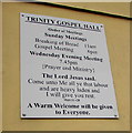
Information board outside Trinity Gospel Hall, Treherbert
On the wall on the right here http://www.geograph.org.uk/photo/5595596 viewed in November 2017.
Image: © Jaggery
Taken: 9 Nov 2017
0.05 miles
8
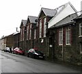
Entrance to Treherbert Community Education Centre
From Dumfries Street. The building is a former school - a faded
inscription in stone on the building shows BOYS SCHOOL REBUILT 1899.
Image: © Jaggery
Taken: 26 Oct 2017
0.05 miles
9
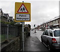
Warning sign - Patrol/Hebryngwr, Bute Street, Treherbert
The English/Welsh sign is alongside the A4061 Bute Street.
Image: © Jaggery
Taken: 9 Nov 2017
0.05 miles
10
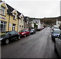
Up Stuart Street, Treherbert
Stuart Street ascends from the A4061 Bute Street past Trinity Gospel Hall http://www.geograph.org.uk/photo/5595596 on the left.
Image: © Jaggery
Taken: 9 Nov 2017
0.05 miles