1
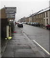
A4061 direction signs, Treherbert
Ahead on the A4061 for Treorchy (Treorci in Welsh). Turn right onto the B4522 for Blaenrhondda.
Image: © Jaggery
Taken: 26 Oct 2017
0.02 miles
2
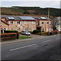
Solar panels on Glenrhondda Court, Treherbert
Modern flats on the north side of Dunraven Street.
Image: © Jaggery
Taken: 13 Nov 2017
0.03 miles
3
Side view of Grade II listed Bethany Baptist Church, Treherbert
Bethany Baptist Church, Abertonllwyd Street, was built as Bethany Baptist Chapel in 1873 in the Classical style, gable entry type. Grade II listed in February 1996.
Image: © Jaggery
Taken: 23 Jan 2012
0.03 miles
4
Front view of Grade II listed Bethany Baptist Church, Treherbert
Bethany Baptist Church, Abertonllwyd Street, was built as Bethany Baptist Chapel in 1873 in the Classical style, gable entry type. Grade II listed in February 1996.
Image: © Jaggery
Taken: 23 Jan 2012
0.03 miles
5
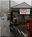
The Devils next home game, Treherbert
On October 26th 2017, the board on a Dunraven Street wall shows that the next home game for Treherbert Rugby Football Club (nickname The Devils) is against Wattstown on Saturday November 4th, kickoff 2:30pm.
Image: © Jaggery
Taken: 26 Oct 2017
0.03 miles
6
A4061 into Treherbert
The A4061 Rhigos Road on the camera side becomes the A4061 Abertonllwyd Street beyond the Hill Street junction on the right ahead.
Image: © Jaggery
Taken: 26 Oct 2017
0.03 miles
7
Dunraven Street bus stop and shelter, Treherbert
This stop near the corner of the A4061 is for buses to Treorchy, Ystrad, Llwynypia, Tonypandy etc.
Image: © Jaggery
Taken: 26 Oct 2017
0.04 miles
8
Abertonllwyd Street, Treherbert
Part of the A4061.
Image: © Jaggery
Taken: 26 Oct 2017
0.04 miles
9
Abertonllwyd Street flats, Treherbert
Viewed across the A4061 Abertonllwyd Street. The corner of Hill Street is on the right.
Image: © Jaggery
Taken: 26 Oct 2017
0.04 miles
10
Treherbert Community Education Centre
Located on Dumfries Street in a former school. A faded inscription in stone on the building is
BOYS SCHOOL REBUILT 1899.
Image: © Jaggery
Taken: 23 Jan 2012
0.04 miles


