1
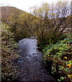
Upstream along the Rhondda River, Treherbert
The Rhondda flows towards the camera on this http://www.geograph.org.uk/photo/5603723 road bridge.
Image: © Jaggery
Taken: 13 Nov 2017
0.01 miles
2
Methodist Church, Treherbert
The modern, single-storey brick church occupies part of the site of the demolished English Wesleyan Methodist church, built in 1884.
Image: © Jaggery
Taken: 23 Jan 2012
0.02 miles
3
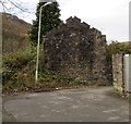
Roofless stone building on a bank of the Rhondda River, Treherbert
Located here. http://www.geograph.org.uk/photo/5604183
Image: © Jaggery
Taken: 13 Nov 2017
0.02 miles
4
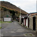
Lane from Upper Taff Street towards Dunraven Street, Treherbert
This part of the lane is on the north bank of the Rhondda River. Near the roofless stone building http://www.geograph.org.uk/photo/5604169 in the background, the lane turns through 90 degrees (to the right) towards Dunraven Street.
Image: © Jaggery
Taken: 13 Nov 2017
0.02 miles
5
Trem y Mynydd, Treherbert
Viewed from Upper Taff Street. Managed by Wales & West Housing, Trem y Mynydd is
retirement housing containing 37 flats. New residents must be at least 55 years old.
Image: © Jaggery
Taken: 13 Nov 2017
0.02 miles
6
Weak road bridge over the Rhondda River, Treherbert
The bridge crosses the Rhondda near the western entrance http://www.geograph.org.uk/photo/5603704 to Treherbert Park. Pont Wan is Welsh for Weak Bridge. 3T mgw indicates 3 tonnes maximum gross weight, the maximum legally permitted weight of a vehicle, including fuel, load, driver, passengers etc.
Image: © Jaggery
Taken: 13 Nov 2017
0.03 miles
7
Treherbert Silver Band hall, Upper Taff Street, Treherbert
A silver band is a brass band playing silver-coloured instruments. Treherbert Silver Band was formed c1897 as Treherbert Drum and Fife Band, later becoming a brass band associated with Glenrhondda Colliery.
Image: © Jaggery
Taken: 13 Nov 2017
0.03 miles
8
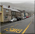
West along Dunraven Street, Treherbert
The B4522 Dunraven Street viewed from the corner of the A4061.
Drizzle is falling in Dunraven Street and low clouds shroud the distant hills on October 25th 2017.
Image: © Jaggery
Taken: 26 Oct 2017
0.04 miles
9
Old railway line
This short section of railway sleepers were once part of the Rhondda & Swansea Bay railway line.
Image: © Helen
Taken: 28 Feb 2015
0.04 miles
10
Hill Street, Treherbert
Looking to the SW along Hill Street towards Dunraven Street on a damp and misty day in October 2017.
Image: © Jaggery
Taken: 26 Oct 2017
0.04 miles


