1
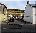
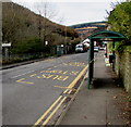
William Street, Tynewydd
Viewed across Gwendoline Street.
Image: © Jaggery
Taken: 13 Nov 2017
0.00 miles
2
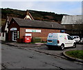
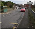
Well Pharmacy and Well van, Tynewydd
Viewed across William Street.
Image: © Jaggery
Taken: 13 Nov 2017
0.00 miles
3
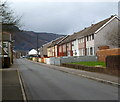
Park Place, Treherbert
Viewed from the Hill Street end.
Image: © Jaggery
Taken: 23 Jan 2012
0.01 miles
4
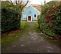
Treherbert OAP Hall
The Old Age Pensioners' Hall is set back about 30 metres from the north side of the B4522 in Treherbert.
Image: © Jaggery
Taken: 13 Nov 2017
0.02 miles
5
Geraint R. Davies Pharmacy, Tynewydd
William Street side of the pharmacy at 59 Gwendoline Street.
Image: © Jaggery
Taken: 13 Nov 2017
0.02 miles
6
Gwendoline Street houses, Tynewydd
Solar panels are on the roof of this http://www.geograph.org.uk/photo/5599579 pharmacy on the corner of William Street.
Image: © Jaggery
Taken: 13 Nov 2017
0.03 miles
7
Gwendoline Street bus stops and shelters in different villages, Treherbert/Tynewydd
If the boundary sign on the left is accurately positioned, the bus stop & shelter on the camera side are in Treherbert, the ones on the opposite side of the road are in Tynewydd. Viewed across the B4522 Gwendoline Street.
Image: © Jaggery
Taken: 13 Nov 2017
0.03 miles
8
Treherbert boundary sign facing Tynewydd
Alongside the B4522 Gwendoline Street. The Tynewydd boundary sign is on the back of this one.
Image: © Jaggery
Taken: 13 Nov 2017
0.04 miles
9
Bobcat and JCB, Gwendoline Street, Tynewydd
Heavy plant alongside the B4522 Gwendoline Street near road resurfacing work http://www.geograph.org.uk/photo/5600161 on November 13th 2017.
Image: © Jaggery
Taken: 13 Nov 2017
0.04 miles
10
Houses on the north side of the B4522 Dunraven Street, Treherbert
Looking towards Gwendoline Street and Tynewydd.
Image: © Jaggery
Taken: 13 Nov 2017
0.04 miles


