IMAGES TAKEN NEAR TO
Ynysfeio Close, TREORCHY, CF42 5HP

Introduction

This page details the photographs taken nearby to Ynysfeio Close, CF42 5HP by members of the Geograph project.

The Geograph project started in 2005 with the aim of publishing, organising and preserving representative images for every square kilometre of Great Britain, Ireland and the Isle of Man.

There are currently over 7.5m images from over14,400 individuals and you can help contribute to the project by visiting https://www.geograph.org.uk

Image Map


Images are licensed for reuse under creativecommons.org/licenses/by-sa/2.0
Notes
  • Clicking on the map will re-center to the selected point.
  • The higher the marker number, the further away the image location is from the centre of the postcode.

Image Listing (110 Images Found)

Images are licensed for reuse under creativecommons.org/licenses/by-sa/2.0
  • ...
Image
Details
Distance
1
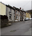
Up Jones Street, Ynyswen
Viewed from the corner of Painters Row. Jones Street ascends past the Ynysfeio Close http://www.geograph.org.uk/photo/5606903 junction.
Image: © Jaggery Taken: 21 Nov 2017
0.02 miles
2
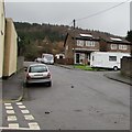
Ynysfeio Close, Ynyswen
Cul-de-sac on the east side of Jones Street.
Image: © Jaggery Taken: 21 Nov 2017
0.02 miles
3
Houses at the top end of Jones Street, Ynyswen
Viewed from the corner of Ynysfeio Close. http://www.geograph.org.uk/photo/5606903
Image: © Jaggery Taken: 21 Nov 2017
0.02 miles
4
Llewelyn Street, Ynyswen
From Jones Street along Llewelyn Street towards Kenry Street.
Image: © Jaggery Taken: 21 Nov 2017
0.03 miles
5
Jones Street, Ynyswen
Ascending from the A4061 Baglan Street.
Image: © Jaggery Taken: 21 Nov 2017
0.03 miles
6
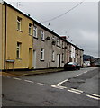
Along Painters Row towards Jones Street, Ynyswen
Viewed from the end of the Painters Row roadway.
Image: © Jaggery Taken: 21 Nov 2017
0.03 miles
7
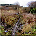
Hillside brook near Painters Row, Ynyswen
A tiny tributary of the Rhondda River.
Image: © Jaggery Taken: 21 Nov 2017
0.06 miles
8
Ynyswen sign
The blue and yellow pub is the Royal Oak
Image: © John Lord Taken: 10 Sep 2008
0.06 miles
9
Painters Row, Ynyswen
Dead end street on the NW side of Jones Street.
Image: © Jaggery Taken: 21 Nov 2017
0.07 miles
10
Ordnance Survey Cut Mark
This OS cut mark can be found on No46 Baglan Street. It marks a point 178.331m above mean sea level.
Image: © Adrian Dust Taken: 28 Apr 2017
0.07 miles
  • ...