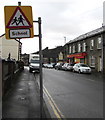
1
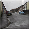
Mount Libanus Street, Treherbert
The SE end of Mount Libanus Street viewed from the corner of Mary Street. Libanus is Welsh for Lebanon.
Image: © Jaggery
Taken: 9 Nov 2017
0.05 miles
2
Ordnance Survey Cut Mark
This OS cut mark can be found on the wall of No21 Bryn Heulog. It marks a point 211.671m above mean sea level.
Image: © Adrian Dust
Taken: 9 Nov 2020
0.06 miles
3
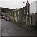
Royal Mail van, John Street, Treherbert
The red van is parked in John Street while its driver delivers letters and small parcels to nearby houses.
Image: © Jaggery
Taken: 9 Nov 2017
0.07 miles
4
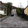
John St, from the corner of Ynysfeio Ave, Pen-yr-englyn, Treherbert
Image: © John Lord
Taken: 10 Sep 2008
0.08 miles
5
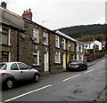
Row of houses, Mary Street, Treherbert
From Baglan Street, Mary Street ascends towards the junction with John Street, Hopkin Street and Mount Libanus Street.
Image: © Jaggery
Taken: 9 Nov 2017
0.08 miles
6
Mary Street houses, Treherbert
Viewed from the corner of Baglan Street.
Image: © Jaggery
Taken: 9 Nov 2017
0.08 miles
7
John Street, Treherbert
John Street ascends towards the Charles Street junction.
Image: © Jaggery
Taken: 9 Nov 2017
0.08 miles
8
Tŷ Heddlu flats, Bute Street, Treherbert
Tŷ Heddlu is Welsh for Police House, which suggests that the flats occupy
the site of Treherbert Police Station which was demolished a decade or more ago.
Image: © Jaggery
Taken: 9 Nov 2017
0.09 miles
9
Ordnance Survey Cut Mark
This damaged OS cut mark can be found on the garage SE side of Corbett Street. It marks a point 200.379m above mean sea level.
Image: © Adrian Dust
Taken: 9 Nov 2020
0.09 miles
10
Monolingual warning sign - School, Bute Street, Treherbert
In November 2017 the School warning sign has not yet been replaced by the Ysgol/School
or School/Ysgol sign more often seen in Wales, such are here http://www.geograph.org.uk/photo/5577157 in Penygraig.
Image: © Jaggery
Taken: 9 Nov 2017
0.10 miles


