IMAGES TAKEN NEAR TO
Rheidol Close, TREORCHY, CF42 5AP

Introduction

This page details the photographs taken nearby to Rheidol Close, CF42 5AP by members of the Geograph project.

The Geograph project started in 2005 with the aim of publishing, organising and preserving representative images for every square kilometre of Great Britain, Ireland and the Isle of Man.

There are currently over 7.5m images from over14,400 individuals and you can help contribute to the project by visiting https://www.geograph.org.uk

Image Map


Images are licensed for reuse under creativecommons.org/licenses/by-sa/2.0
Notes
  • Clicking on the map will re-center to the selected point.
  • The higher the marker number, the further away the image location is from the centre of the postcode.

Image Listing (111 Images Found)

Images are licensed for reuse under creativecommons.org/licenses/by-sa/2.0
  • ...
Image
Details
Distance
1
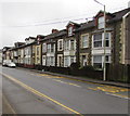
Rheidol Close, Ynyswen
Penyrenglyn Primary School is behind the camera.
Image: © Jaggery Taken: 21 Nov 2017
0.02 miles
2
Down Jones Street, Ynyswen
Jones Street descends to the A4061 Baglan Street.
Image: © Jaggery Taken: 21 Nov 2017
0.03 miles
3
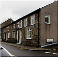
Baglan Street houses, Ynyswen
Viewed across the A4061 Ynyswen Road.
Image: © Jaggery Taken: 21 Nov 2017
0.03 miles
4
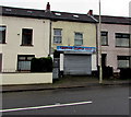
Blue Sky in Ynyswen
Blue Sky Chinese takeaway is at 74 Baglan Street, Ynyswen. A home delivery service is available.
Image: © Jaggery Taken: 21 Nov 2017
0.03 miles
5
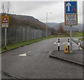
Industrial estates direction signs, Ynyswen
Facing the A4061 Baglan Street. Turn left ahead for Ynyswen Industrial Estate and Treherbert Industrial Estate. The text is also in Welsh.
Image: © Jaggery Taken: 21 Nov 2017
0.03 miles
6
Ordnance Survey Cut Mark
This OS cut mark can be found on No46 Baglan Street. It marks a point 178.331m above mean sea level.
Image: © Adrian Dust Taken: 28 Apr 2017
0.03 miles
7
Royal Oak pub, Ynyswen
Located a few metres on the Ynyswen side of the Pen-yr-englyn boundary, alongside Baglan Street (A4061). Update November 2017. The pub has closed and the building converted to residential use. http://www.geograph.org.uk/photo/5606807
Image: © Jaggery Taken: 23 Jan 2012
0.04 miles
8
Stone houses, Baglan Street, Ynyswen
Viewed past the corner of Jones Street.
Image: © Jaggery Taken: 21 Nov 2017
0.04 miles
9
Traffic calming on the approach to Penyrenglyn Community Primary School
A speed bump is across the narrow part of the road on the approach to this http://www.geograph.org.uk/photo/5608176 school.
Image: © Jaggery Taken: 21 Nov 2017
0.04 miles
10
Former Royal Oak pub, Ynyswen
Viewed in November 2017. The pub seen here http://www.geograph.org.uk/photo/2776594 in January 2012 has closed down and the building converted to residential use.
Image: © Jaggery Taken: 21 Nov 2017
0.04 miles
  • ...