1
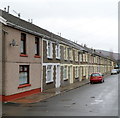
Dorothy Street houses, Gelli
The north side of Dorothy Street viewed from the corner of Mount Zion Pentecostal Church. http://www.geograph.org.uk/photo/3066235
At the far end of the street are riverside railings and a footbridge over the Rhondda Fawr river.
Image: © Jaggery
Taken: 3 Nov 2011
0.03 miles
2
Gelli Primary School
Viewed from Ystrad Road (A4058).
Image: © Jaggery
Taken: 3 Nov 2011
0.03 miles
3
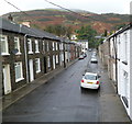
A view from Hillside Terrace, Gelli
Looking along Hillside Terrace and Tyisaf Road. The high ground in the distance is the slope of Mynydd yr Eglwys, part of the range separating the valley of the Rhondda Fawr river on this side from the valley of the Rhondda Fach river on the far side of the range.
Image: © Jaggery
Taken: 3 Nov 2011
0.04 miles
4
Rhondda Line railway viewed from Gelli
Viewed from Tyisaf Road bridge http://www.geograph.org.uk/photo/3066200 looking in the direction of Ystrad Rhondda station. http://www.geograph.org.uk/photo/2793410
Image: © Jaggery
Taken: 3 Nov 2011
0.05 miles
5
Ordnance Survey Cut Mark
This OS cut mark can be found on east wall of the railway bridge. It marks a point 153.241m above mean sea level.
Image: © Adrian Dust
Taken: 7 May 2017
0.05 miles
6
Rhondda Fawr downstream from Tyisaf Road bridge, Gelli
The river flows eastwards away from this http://www.geograph.org.uk/photo/3066271 bridge.
Image: © Jaggery
Taken: 3 Nov 2011
0.05 miles
7
Steps up to a railway footbridge, Gelli
The steps are at the southern end of the street named Gelli Crossing.
The footbridge crosses the Rhondda Line railway.
Image: © Jaggery
Taken: 3 Nov 2011
0.06 miles
8
Gelli Crossing, Gelli
A view north along the street from the steps http://www.geograph.org.uk/photo/3064906 of a railway footbridge.
Image: © Jaggery
Taken: 3 Nov 2011
0.06 miles
9
Gelli Crossing, Gelli
Houses on the west side of a street named Gelli Crossing,
viewed from a bridge over the Rhondda Fawr river.
Image: © Jaggery
Taken: 3 Nov 2011
0.06 miles
10
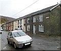
Shady Road, Gelli
Viewed from the railway footbridge http://www.geograph.org.uk/photo/3064906 end of the street. According to one source, this is the only Shady Road in the UK, though there are about a dozen streets named Shady Lane.
Image: © Jaggery
Taken: 3 Nov 2011
0.07 miles


