1
Tyisaf Road railway bridge, Gelli
The bridge carries the road over the Merthyr Line, here single track. A plate fixed to the bridge records that it was made by Patent Shaft & Axletree Co Ltd of Wednesbury in 1932.
Image: © Jaggery
Taken: 3 Nov 2011
0.02 miles
2
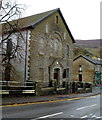
Mount Zion Pentecostal Church, Gelli
Located on the corner of Tyisaf Road and Dorothy Street.
Formerly Duffryn Welsh Calvinistic Methodist Chapel, built in the 1890s.
Image: © Jaggery
Taken: 3 Nov 2011
0.02 miles
3
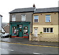
Joan's Wool Shop, Gelli
The dark green shop on the corner of Tyisaf Road and Dorothy Street has no nameboard on display. Notices in the window and on the glass above the doorway show that this is Joan's Wool Shop.
Image: © Jaggery
Taken: 3 Nov 2011
0.02 miles
4
Monkton's Stores, Gelli
D.G.Monkton Ltd off licence and general stores, located on the corner of Tyisaf Road and Ystrad Terrace.
Image: © Jaggery
Taken: 3 Nov 2011
0.02 miles
5
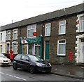
Gelli Post Office
Located in Tyisaf Road. A few metres from the postbox on the left, there is a disused George V postbox in the wall. The former postbox's aperture is sealed off.
Image: © Jaggery
Taken: 3 Nov 2011
0.02 miles
6
A view from Hillside Terrace, Gelli
Looking along Hillside Terrace and Tyisaf Road. The high ground in the distance is the slope of Mynydd yr Eglwys, part of the range separating the valley of the Rhondda Fawr river on this side from the valley of the Rhondda Fach river on the far side of the range.
Image: © Jaggery
Taken: 3 Nov 2011
0.03 miles
7
Ordnance Survey Cut Mark
This OS cut mark can be found on east wall of the railway bridge. It marks a point 153.241m above mean sea level.
Image: © Adrian Dust
Taken: 7 May 2017
0.04 miles
8
JCB, and a boundary sign facing the wrong way, Gelli
A view south along Tyisaf Road across a railway bridge. I was surprised to see on the right an Ystrad boundary sign facing me, as I thought I was leaving Ystrad and Gelli. A Google Earth Street View taken some time before this view shows the sign facing in the opposite direction, so it seems that someone has rotated the sign on the post.
Image: © Jaggery
Taken: 3 Nov 2011
0.05 miles
9
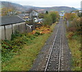
A view west along the Rhondda Line, Gelli
Viewed from this http://www.geograph.org.uk/photo/3064906 footbridge.
The next station in this direction is Ton Pentre. http://www.geograph.org.uk/photo/2682992
Image: © Jaggery
Taken: 3 Nov 2011
0.05 miles
10
Road bridge over the Rhondda Fawr, Gelli
Tyisaf Road crosses the Rhondda Fawr river. The bus shelter is built into the bridge's structure.
Image: © Jaggery
Taken: 3 Nov 2011
0.05 miles


