1
Ysgol Gynradd Gymraeg Bodringallt, Ystrad
This is the SE part of the primary school, on the corner of Victoria Street and Arthur Street. The school is a Welsh Medium school, where all subjects are taught using the medium of the Welsh language.
Image: © Jaggery
Taken: 28 Oct 2011
0.02 miles
2
Ordnance Survey Flush Bracket (S1302)
This OS Flush Bracket can be found on the school. It marks a point 157.035m above mean sea level.
Image: © Adrian Dust
Taken: 6 May 2017
0.05 miles
3
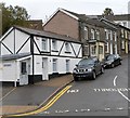
Black and white house, Ivor Street, Ystrad Rhondda
The house on the corner of Ivor Street and William Street is prosaically named
Ty Gwyn, Welsh for White House.
Image: © Jaggery
Taken: 3 Nov 2011
0.05 miles
4
Llys Ben Bowen Thomas, Ystrad
Viewed across Gelligaled Road from the corner of Brook Street. Managed by Wales & West Housing,
Llys Ben Bowen Thomas is retirement/sheltered housing containing 39 flats.
Image: © Jaggery
Taken: 30 Mar 2015
0.06 miles
5
Brook Street electricity substation, Ystrad
The Western Power Distribution electricity substation identifier is
BROOK ST (YSTRAD) S/S 541894.
Image: © Jaggery
Taken: 30 Mar 2015
0.07 miles
6
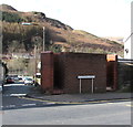
William Street urinal, Ystrad
The brick building on the corner of William Street and Brook Street is a urinal (no pedestals or wash basins). Though such facilities have largely disappeared from many parts of South Wales,
basic urinals (of varying designs) remain a common sight here in the Rhondda.
Image: © Jaggery
Taken: 30 Mar 2015
0.07 miles
7
Gelligaled Road, Ystrad
Houses on the north side of the A4058, here named Gelligaled Road.
Viewed from the crossroads with Tyntyla Terrace and Cross Street.
Image: © Jaggery
Taken: 28 Oct 2011
0.08 miles
8
The Galed, Ystrad
Located on the corner of Gelligaled Road and Brook Street.
Previously coloured dark blue and named The Galed Inn, the building was given a makeover after becoming an Elite Inns pub.
Image: © Jaggery
Taken: 28 Oct 2011
0.08 miles
9
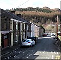
Brook Street, Ystrad
Viewed from the A4058 end looking towards Ystrad Rhondda railway station.
The left turn ahead is into Redfield Street.
Image: © Jaggery
Taken: 30 Mar 2015
0.08 miles
10
Ordnance Survey Cut Mark
This OS cut mark can be found on No7 Gelligaled Road. It marks a point 153.318m above mean sea level.
Image: © Adrian Dust
Taken: 7 May 2017
0.09 miles


