1
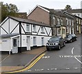
Black and white house, Ivor Street, Ystrad Rhondda
The house on the corner of Ivor Street and William Street is prosaically named
Ty Gwyn, Welsh for White House.
Image: © Jaggery
Taken: 3 Nov 2011
0.05 miles
2
Ysgol Gynradd Gymraeg Bodringallt, Ystrad
This is the SE part of the primary school, on the corner of Victoria Street and Arthur Street. The school is a Welsh Medium school, where all subjects are taught using the medium of the Welsh language.
Image: © Jaggery
Taken: 28 Oct 2011
0.07 miles
3
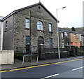
Ystrad Rhondda Boys Club
Located in the former Bethel chapel, William Street. The tablet above the upper floor windows shows the year 1870. At the top of the door arch is Ystrad Rhondda BC 1946.
Image: © Jaggery
Taken: 3 Nov 2011
0.07 miles
4
Ordnance Survey Cut Mark
This OS cut mark can be found on No53 Bodringallt Terrace. It marks a point 169.838m above mean sea level.
Image: © Adrian Dust
Taken: 6 May 2017
0.08 miles
5
Ordnance Survey Flush Bracket (S1302)
This OS Flush Bracket can be found on the school. It marks a point 157.035m above mean sea level.
Image: © Adrian Dust
Taken: 6 May 2017
0.09 miles
6
Llys Ben Bowen Thomas, Ystrad
Viewed across Gelligaled Road from the corner of Brook Street. Managed by Wales & West Housing,
Llys Ben Bowen Thomas is retirement/sheltered housing containing 39 flats.
Image: © Jaggery
Taken: 30 Mar 2015
0.10 miles
7
Arthur Street, Ystrad Rhondda
Houses on the north side of Arthur Street, viewed from Sandybank Road.
Image: © Jaggery
Taken: 3 Nov 2011
0.11 miles
8
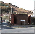
William Street urinal, Ystrad
The brick building on the corner of William Street and Brook Street is a urinal (no pedestals or wash basins). Though such facilities have largely disappeared from many parts of South Wales,
basic urinals (of varying designs) remain a common sight here in the Rhondda.
Image: © Jaggery
Taken: 30 Mar 2015
0.11 miles
9
Brook Street electricity substation, Ystrad
The Western Power Distribution electricity substation identifier is
BROOK ST (YSTRAD) S/S 541894.
Image: © Jaggery
Taken: 30 Mar 2015
0.11 miles
10
Ystrad Rhondda Rugby Football Club social club
Located at 73 William Street. This view was taken in November 2011, during the 2011-2012 rugby season, at the end of which Ystrad Rhondda Rugby Football Club won the SWALEC Division 2 East title, gaining promotion to SWALEC National League Division 1 East for the 2012-2013 season.
Image: © Jaggery
Taken: 3 Nov 2011
0.11 miles


