
IMAGES TAKEN NEAR TO
Arthur Street, PENTRE, CF41 7QB
Introduction
This page details the photographs taken nearby to Arthur Street, CF41 7QB by members of the Geograph project.
The Geograph project started in 2005 with the aim of publishing, organising and preserving representative images for every square kilometre of Great Britain, Ireland and the Isle of Man.

There are currently over 7.5m images from over14,400 individuals and you can help contribute to the project by visiting https://www.geograph.org.uk
Image Map
Images are licensed for reuse under creativecommons.org/licenses/by-sa/2.0
Notes
- Clicking on the map will re-center to the selected point.
- The higher the marker number, the further away the image location is from the centre of the postcode.
Image Listing (60 Images Found)
Images are licensed for reuse under creativecommons.org/licenses/by-sa/2.0
Image
Details
Distance
1
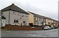
Arthur Street, Ystrad Rhondda
Houses on the north side of Arthur Street, viewed from Sandybank Road.
Image: © Jaggery
Taken: 3 Nov 2011
0.02 miles
2
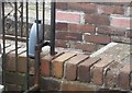
Ordnance Survey Cut Mark
This OS cut mark can be found on No53 Bodringallt Terrace. It marks a point 169.838m above mean sea level.
Image: © Adrian Dust
Taken: 6 May 2017
0.04 miles
3
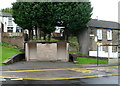
Basic urinal, Ystrad Rhondda
Located on the corner of Sandybank Road and William Street, the small structure with two doorways is a basic urinal (no pedestals or wash basins). Though such facilities have largely disappeared from many parts of South Wales, basic urinals (of varying designs) remain a common sight in the Rhondda.
Image: © Jaggery
Taken: 3 Nov 2011
0.05 miles
4
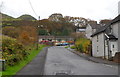
Sandybank Road, Ystrad Rhondda
Sandybank Road climbs away from Williams Street past the turning for Arthur Street. http://www.geograph.org.uk/photo/3064851
Image: © Jaggery
Taken: 3 Nov 2011
0.06 miles
5
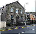
Ystrad Rhondda Boys Club
Located in the former Bethel chapel, William Street. The tablet above the upper floor windows shows the year 1870. At the top of the door arch is Ystrad Rhondda BC 1946.
Image: © Jaggery
Taken: 3 Nov 2011
0.09 miles
6
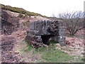
Abandoned structure near Ystrad Rhondda
Image: © Gareth James
Taken: 4 Apr 2015
0.10 miles
7
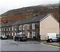
William Street houses, Ystrad Rhondda
Part of a long row of houses on the north side of William Street.
Image: © Jaggery
Taken: 3 Nov 2011
0.10 miles
8
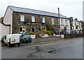
The Greenfield, Ystrad Rhondda
Pub at 13-14 William Street (the A4058).
Image: © Jaggery
Taken: 3 Nov 2011
0.11 miles
9
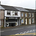
Dunning's Plaice, Ystrad Rhondda
Fish and chip shop in William Street, facing the Sandybank Road junction.
Image: © Jaggery
Taken: 3 Nov 2011
0.11 miles
10
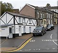
Black and white house, Ivor Street, Ystrad Rhondda
The house on the corner of Ivor Street and William Street is prosaically named
Ty Gwyn, Welsh for White House.
Image: © Jaggery
Taken: 3 Nov 2011
0.12 miles