1
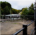
Tiles Today, 65 Ystrad Road, Pentre
Viewed from Ton Pentre railway station.
Image: © Jaggery
Taken: 8 Oct 2018
0.01 miles
2
CAUTION - DEEP EXCAVATION - KEEP OUT, Ton Pentre
The notice is on temporary fencing at the edge of Ton Pentre railway station on October 8th 2018.
Image: © Jaggery
Taken: 8 Oct 2018
0.03 miles
3
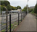
Fenced-off area beyond Ton Pentre railway station
In October 2018 a caution notice on the temporary fencing shows DEEP EXCAVATION - KEEP OUT https://www.geograph.org.uk/photo/6194339
Image: © Jaggery
Taken: 8 Oct 2018
0.03 miles
4
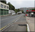
Ystrad Road, Ton Pentre
Looking to the SE along the A4058 Ystrad Road. A Texaco filling station is on the right.
Image: © Jaggery
Taken: 8 Oct 2018
0.03 miles
5
Ton Pentre railway station viewed from Church Road bridge
The NW part of the station (nearest the camera) is built on a bridge across a river, the Rhondda Fawr. The single-platform station is on the Rhondda Line between Treorchy station about a mile behind the camera, and Ystrad Rhondda station, nearly a mile ahead.
Image: © Jaggery
Taken: 3 Nov 2011
0.05 miles
6
Ystrad Road passes Ton Pentre railway station
A view to the SE along the A4058 Ystrad Road. Ton Pentre railway station http://www.geograph.org.uk/photo/2682877 is on the Rhondda Line, between Treorchy station and Ystrad Rhondda station.
Image: © Jaggery
Taken: 3 Nov 2011
0.05 miles
7
4U Recruitment, Ton Pentre
Viewed from Ton Pentre railway station. http://www.geograph.org.uk/photo/2682877 A sign on the Ystrad Road premises shows
4U RECRUITMENT. Jobs in: Rail, London Underground, Crane & Plant, Construction, Driving, Industrial, Power & Utilities, Civil Engineering.
Image: © Jaggery
Taken: 3 Nov 2011
0.05 miles
8
Texaco Ton Pentre
Texaco filling station alongside the A4058 Ystrad Road viewed from Ton Pentre railway station in October 2018.
Image: © Jaggery
Taken: 8 Oct 2018
0.05 miles
9
Telecoms mast in Ton Pentre
Opposite the single-track single-platform Ton Pentre station.
Image: © Jaggery
Taken: 8 Oct 2018
0.05 miles
10
Ton Pentre railway station, Rhondda Cynon Taf, 2014
Opened in 1863 as "Ystrad" by the Taff Vale Railway on the line from Cardiff to Treherbert, this replaced an earlier 1861 station just behind the camera position. The name was changed to "Ystrad Rhondda" in 1930, and then to "Ton Pentre" in 1986 (when the station now known as Ystrad Rhondda was opened).
View south east towards Ystrad Rhondda and Cardiff, some nine years before the railway line here was electrified. See
Image for a 2024 view from a similar camera position.
There was formerly a northbound line and platform to the right, even though the section closest to the camera is built over the river (just visible to the left of the blue fencing).
Image: © Nigel Thompson
Taken: 13 Jun 2014
0.06 miles


