1
Churchfield Row, Pentre
Churchfield Row ascends from Pleasant View.
Image: © Jaggery
Taken: 8 Oct 2018
0.02 miles
2
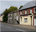
Zion House under scaffolding, Pleasant View, Pentre
Viewed in early October 2018. Zion House is on the site formerly
occupied by Zion English Baptist Chapel which was built in 1878.
Image: © Jaggery
Taken: 8 Oct 2018
0.04 miles
3
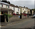
Row of houses, Pleasant View, Pentre
Extending for 55 metres alongside the road named Pleasant View.
Image: © Jaggery
Taken: 8 Oct 2018
0.04 miles
4
Pleasant View cars and houses, Pentre
This part of Pleasant View is southeast of the Churchfield Row junction.
Image: © Jaggery
Taken: 8 Oct 2018
0.05 miles
5
Pleasant View, Pentre
Dead-end road Pleasant View ascends from the A4058 junction.
Image: © Jaggery
Taken: 8 Oct 2018
0.05 miles
6
Pleasant View houses, Pentre
This part of Pleasant View is southeast of the Churchfield Row junction.
Image: © Jaggery
Taken: 8 Oct 2018
0.05 miles
7
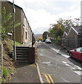
Steps up to Pleasant View houses, Pentre
Dead-end Pleasant View connects with the A4058 behind the camera.
Image: © Jaggery
Taken: 8 Oct 2018
0.05 miles
8
Ordnance Survey Cut Mark
This OS cut mark can be found on No21 Ystrad Road. It marks a point 160.240m above mean sea level.
Image: © Adrian Dust
Taken: 7 May 2017
0.06 miles
9
Danger! Keep out of the channel, Pentre
The notice is alongside the road named Pleasant View. Offenders disregarding this notice will be prosecuted by order of Rhondda Cynon Taff County Borough Council. The text is also in Welsh.
Image: © Jaggery
Taken: 8 Oct 2018
0.06 miles
10
Pentre Surgery, Ystrad Road, Pentre
Medical surgery viewed across the A4058 Ystrad Road.
Image: © Jaggery
Taken: 8 Oct 2018
0.07 miles


