1
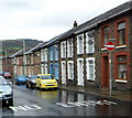
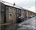
Llanfair Hill houses, Gelli
Houses on the south side of the street viewed from the corner of Smith Street.
Image: © Jaggery
Taken: 3 Nov 2011
0.02 miles
2
Ordnance Survey Cut Mark
This OS cut mark can be found on No11 Llanfair Hill. It marks a point 169.938m above mean sea level.
Image: © Adrian Dust
Taken: 7 May 2017
0.03 miles
3
Bronllwyn Integrated Resource Centre, Gelli
Viewed across Smith Street. The Rhondda Cynon Taf premises include a residential care unit and day services.
Image: © Jaggery
Taken: 3 Nov 2011
0.05 miles
4
Welsh language primary school, Gelli
Viewed from Conway Road. Ysgol Gynradd Gymraeg Bronllwyn is a Welsh medium primary school. Welsh medium means that lessons are conducted using the medium of the Welsh language.
Image: © Jaggery
Taken: 3 Nov 2011
0.07 miles
5
Bryn Seion Court, Gelli
A block of 12 flats on the corner of Avondale Road and Smith Street.
The building occupies the site of the demolished Bryn Seion Welsh Independent chapel.
Image: © Jaggery
Taken: 3 Nov 2011
0.10 miles
6
One-way system, Bronllwyn Road,Gelli
There is a one-way system operating along this part of Bronllwyn Road, west of Smith Street.
Image: © Jaggery
Taken: 3 Nov 2011
0.10 miles
7
King Street houses, Gelli
Houses on the north side of the street, viewed from the corner of Smith Street looking towards Ravenhill Street.
Image: © Jaggery
Taken: 3 Nov 2011
0.10 miles
8
Bronllwyn Road houses, Gelli
Houses on the north side of Bronllwyn Road viewed from the corner of Smith Street.
Image: © Jaggery
Taken: 3 Nov 2011
0.10 miles
9
View across the back gardens of Bronllwyn Rd and Avondale Rd, Gelli
The radio mast at SS961956 can be seen on the hilltop in the distance.
Image: © John Lord
Taken: 10 Sep 2008
0.11 miles
10
Bronllwyn Rd, Gelli
Image: © John Lord
Taken: 10 Sep 2008
0.12 miles


