1
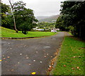
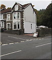
Unnamed road on the north side of Pentwyn Road, Ton Pentre
Descending towards the Rhondda River.
Image: © Jaggery
Taken: 8 Oct 2018
0.06 miles
2
Bench alongside Pentwyn Road, Ton Pentre
On the north side of the B4223 Pentwyn Road.
Image: © Jaggery
Taken: 8 Oct 2018
0.07 miles
3
Western Power Distribution line spur pole, Ton Pentre
A rural part of the electricity supply infrastructure on the north side of the B4223.
Image: © Jaggery
Taken: 8 Oct 2018
0.07 miles
4
Pentwyn Road, Ton Pentre
The B4223 Maindy Road is behind the camera. The B4223 Pentwyn Road is ahead.
Image: © Jaggery
Taken: 8 Oct 2018
0.07 miles
5
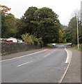
Road from Ton Pentre towards Treorchy
The B4223 Pentwyn Road heads away from Ton Pentre.
Image: © Jaggery
Taken: 8 Oct 2018
0.08 miles
6
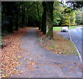
Tree-lined pavement, Pentwyn Road, Ton Pentre
The pavement diverges from the south side of the B4223 Pentwyn Road.
Image: © Jaggery
Taken: 8 Oct 2018
0.08 miles
7
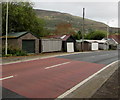
Maindy Crescent lockup garages, Ton Pentre
On the north side of the B4223 Maindy Crescent. The garage on the right is opposite Maindy Croft. https://www.geograph.org.uk/photo/5933304
Image: © Jaggery
Taken: 8 Oct 2018
0.08 miles
8
Junction of Maindy Croft and the B4223, Ton Pentre
The houses are in Maindy Croft. https://www.geograph.org.uk/photo/5933304
Image: © Jaggery
Taken: 8 Oct 2018
0.09 miles
9
Ordnance Survey Cut Mark
This OS cut mark can be found on the wall of Coed Cae. It marks a point 161.276m above mean sea level.
Image: © Adrian Dust
Taken: 7 May 2017
0.10 miles
10
Ordnance Survey Cut Mark
This OS cut mark can be found behind the wall post of the Alexandra Hotel. It marks a point 153.592m above mean sea level.
Image: © Adrian Dust
Taken: 7 May 2017
0.10 miles


