1
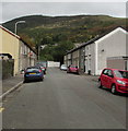
Crawshay Street, Ton Pentre
Dead-end street on the northeast side of Bailey Street.
Image: © Jaggery
Taken: 8 Oct 2018
0.01 miles
2
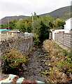
North along Nant Ian, Ton Pentre
Nant Ian flows away from Bailey Street towards the Rhondda Fawr river about 70 metres from the camera.
Image: © Jaggery
Taken: 8 Oct 2018
0.03 miles
3
Augusta Street, Ton Pentre
Dead-end street on the northeast side of Bailey Street.
Image: © Jaggery
Taken: 8 Oct 2018
0.03 miles
4
Rhondda Line heads away from Ton Pentre station
Viewed from the Church Road (B4223) bridge. Ton Pentre railway station http://www.geograph.org.uk/photo/2682877 is on the other side of the bridge. The line heads NW towards Treorchy station, about a mile (1.6km) away.
Image: © Jaggery
Taken: 3 Nov 2011
0.04 miles
5
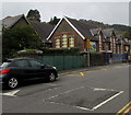
Bailey Street speed bumps, Ton Pentre
On the approach to Ton Pentre Junior School. https://www.geograph.org.uk/photo/5933223
Image: © Jaggery
Taken: 8 Oct 2018
0.04 miles
6
Warning sign - School/Ysgol, Bailey Street, Ton Pentre
The English/Welsh sign is on the approach to Ton Pentre Junior School. https://www.geograph.org.uk/photo/5933223
Image: © Jaggery
Taken: 8 Oct 2018
0.04 miles
7
Junction of Augusta Street and Bailey Street, Ton Pentre
Augusta Street from the right (northeast) joins Bailey Street.
Image: © Jaggery
Taken: 8 Oct 2018
0.04 miles
8
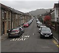
Bailey Street, Ton Pentre
Looking to the SE along Bailey Street past speed bumps.
Church Road and Church Street are ahead.
Image: © Jaggery
Taken: 8 Oct 2018
0.05 miles
9
Row of stone houses, Bailey Street, Ton Pentre
This part of Bailey Street is between Queen Street and Augusta Street.
Image: © Jaggery
Taken: 8 Oct 2018
0.05 miles
10
Ordnance Survey Cut Mark
This OS cut mark can be found on the east angle of the school. It marks a point 153.522m above mean sea level.
Image: © Adrian Dust
Taken: 7 May 2017
0.05 miles


