IMAGES TAKEN NEAR TO
PORTH, CF40 9BS

Introduction

This page details the photographs taken nearby to CF40 9BS by members of the Geograph project.

The Geograph project started in 2005 with the aim of publishing, organising and preserving representative images for every square kilometre of Great Britain, Ireland and the Isle of Man.

There are currently over 7.5m images from over14,400 individuals and you can help contribute to the project by visiting https://www.geograph.org.uk

Image Map


Images are licensed for reuse under creativecommons.org/licenses/by-sa/2.0
Notes
  • Clicking on the map will re-center to the selected point.
  • The higher the marker number, the further away the image location is from the centre of the postcode.

Image Listing (23 Images Found)

Images are licensed for reuse under creativecommons.org/licenses/by-sa/2.0
  • ...
Image
Details
Distance
1
Old Colliery Site Reclamation Scheme
Site of the old Gorki Colliery.
Image: © kenneth rees Taken: 19 Apr 2007
0.11 miles
2
Council Offices road
Image: © Colin Pyle Taken: 9 Sep 2011
0.12 miles
3
Lower lake
The lower lake at Cwm Clydach.
Image: © Alan Hughes Taken: 11 Apr 2019
0.14 miles
4
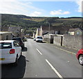
Down Bryn Terrace, Tonypandy
Descending towards Jones Street and Railway Terrace.
Image: © Jaggery Taken: 5 Oct 2017
0.19 miles
5
South side of North Terrace, Tonypandy
North Terrace descends towards Jones Street and Railway Terrace.
Image: © Jaggery Taken: 5 Oct 2017
0.19 miles
6
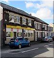
Cambrian Chippy in Tonypandy
Fish & chips shop at 112 Court Street, on the corner of North Terrace.
Image: © Jaggery Taken: 5 Oct 2017
0.22 miles
7
Clydach Stores, 19-20 Clydach Road, Clydach Vale
Convenience store and off licence viewed from the corner of Glyn Terrace.
Image: © Jaggery Taken: 5 Oct 2017
0.22 miles
8
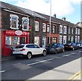
Clydach MiniMarket, 11 Clydach Road, Clydach Vale
Viewed in October 2017. An August 2012 Google Earth Street View shows Lynne's News shop here.
Image: © Jaggery Taken: 5 Oct 2017
0.22 miles
9
East along Clydach Road, Clydach Vale
This way to Tonypandy. Clydach Stores http://www.geograph.org.uk/photo/5561998 are on the right.
Image: © Jaggery Taken: 5 Oct 2017
0.23 miles
10
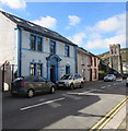
Former County Police Station, Clydach Road, Clydach Vale
Dated 1913, the former police station is the premises of Cwm Clydach Community Development Trust in 2017. The Church of St Thomas http://www.geograph.org.uk/photo/5560520 is on the right.
Image: © Jaggery Taken: 5 Oct 2017
0.23 miles
  • ...