IMAGES TAKEN NEAR TO
Court Place, TONYPANDY, CF40 2RE
Introduction
This page details the photographs taken nearby to Court Place, CF40 2RE by members of the Geograph project.
The Geograph project started in 2005 with the aim of publishing, organising and preserving representative images for every square kilometre of Great Britain, Ireland and the Isle of Man.

There are currently over 7.5m images from over14,400 individuals and you can help contribute to the project by visiting https://www.geograph.org.uk
Image Map
Images are licensed for reuse under creativecommons.org/licenses/by-sa/2.0
Notes
- Clicking on the map will re-center to the selected point.
- The higher the marker number, the further away the image location is from the centre of the postcode.
Image Listing (165 Images Found)
Images are licensed for reuse under creativecommons.org/licenses/by-sa/2.0
Image
Details
Distance
1

Benchmark Court Place, Court Street, Tonypandy
An Ordnance Survey Cut Mark can be found on a short wall at the entrance to Court Place, Court Street, Tonypandy. It marks a height of 155.360m above mean sea level.
Image: © John Jenkins
Taken: 23 Sep 2025
0.01 miles
2
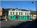
The Pandy, Tonypandy
Pub located at the crossroads of De Winton Street, Llwynypia Road, Court Street and Church Street. Though not named as such on maps, this area is often referred to as Tonypandy Square or Pandy Square.
Image: © Jaggery
Taken: 28 Oct 2011
0.02 miles
3
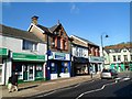
Tonypandy Square shops
Viewed along De Winton Street looking towards The Pandy. http://www.geograph.org.uk/photo/2674608
Image: © Jaggery
Taken: 28 Oct 2011
0.02 miles
4
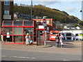
Tonypandy bus station
Viewed across Court Street.
Image: © Jaggery
Taken: 28 Oct 2011
0.02 miles
5
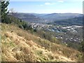
Clydach Vale
View along Cwm Clydach towards Tonypandy and in the direction of Porth and Pontypridd.
Image: © Alan Hughes
Taken: 11 Apr 2019
0.02 miles
6
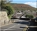
Bend in Court Street, Tonypandy
On the descent to the centre of Tonypandy. Double yellow lines on both sides indicate no parking at any time.
A white cross is on the distant hillside.
Image: © Jaggery
Taken: 5 Oct 2017
0.03 miles
7
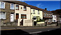
Houses on the north side of Court Street, Tonypandy
On the descent towards the centre of Tonypandy.
Image: © Jaggery
Taken: 5 Oct 2017
0.03 miles
8
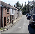
Chapel Street, Tonypandy
Dead end street extending for 60 metres from the south side of Court Street.
Image: © Jaggery
Taken: 5 Oct 2017
0.04 miles
9
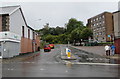
West along Court Street, Tonypandy
Viewed from the corner of Church Street. Well Pharmacy http://www.geograph.org.uk/photo/5545880 is on the left.
The walkers are approaching Tonypandy bus station. http://www.geograph.org.uk/photo/5544730
Image: © Jaggery
Taken: 21 Sep 2017
0.04 miles