IMAGES TAKEN NEAR TO
Mr Speakers Way, TONYPANDY, CF40 2PS
Introduction
This page details the photographs taken nearby to Mr Speakers Way, CF40 2PS by members of the Geograph project.
The Geograph project started in 2005 with the aim of publishing, organising and preserving representative images for every square kilometre of Great Britain, Ireland and the Isle of Man.

There are currently over 7.5m images from over14,400 individuals and you can help contribute to the project by visiting https://www.geograph.org.uk
Image Map
Images are licensed for reuse under creativecommons.org/licenses/by-sa/2.0
Notes
- Clicking on the map will re-center to the selected point.
- The higher the marker number, the further away the image location is from the centre of the postcode.
Image Listing (172 Images Found)
Images are licensed for reuse under creativecommons.org/licenses/by-sa/2.0
Image
Details
Distance
1
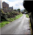
Old Brithweunydd Road, Trealaw
Dead-end road on the south side of the B4278 Brithweunydd Road.
Image: © Jaggery
Taken: 28 Sep 2017
0.08 miles
2
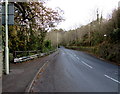
Metal barrier alongside the B4278 Dinas Road in Penygraig
Above the Rhondda River (Afon Rhondda Fawr in Welsh).
Image: © Jaggery
Taken: 17 Oct 2017
0.09 miles
3
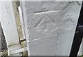
Ordnance Survey Cut Mark
This OS cut mark can be found on Coldra House, Brithweunydd Road. It marks a point 141.196m above mean sea level.
Image: © Adrian Dust
Taken: 21 May 2017
0.10 miles
4
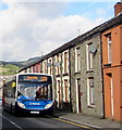
Caerphilly bus in Trealaw
The Stagecoach bus on the B4278 Brithweunydd Road is on bus route 120 to Caerphilly via Porth and Pontypridd.
Image: © Jaggery
Taken: 28 Sep 2017
0.10 miles
5
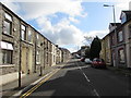
East along Brithweunydd Road, Trealaw
The B4278 Brithweunydd Road viewed from near the corner of Victoria Street.
Image: © Jaggery
Taken: 28 Sep 2017
0.10 miles
6
Warning sign - School/Ysgol, Dinas Road, Penygraig
The English/Welsh sign faces the B4278 Dinas Road on the approach to Tai Educational Centre.
Image: © Jaggery
Taken: 17 Oct 2017
0.10 miles
7
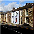
Brownish house on a Trealaw corner
Orangish brown house on the corner of Brithweunydd Road and Maesyffynon Terrace.
Image: © Jaggery
Taken: 28 Sep 2017
0.11 miles
8
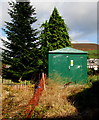
Broadfield Close electricity substation, Penygraig
The green cabinet is a Western Power Distribution electricity substation
located at the western end of Broadfield Close, opposite a path from Vicarage Road.
Image: © Jaggery
Taken: 17 Oct 2017
0.11 miles
9
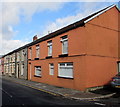
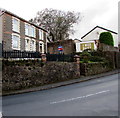
Houses and satellite dishes, Trealaw
On the north side of the B4278 Brithweunydd Road viewed in September 2017.
Image: © Jaggery
Taken: 28 Sep 2017
0.11 miles
10
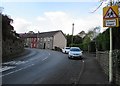
Houses above a bend in Dinas Road, Penygraig
Viewed across the B4278 Dinas Road.
Image: © Jaggery
Taken: 17 Oct 2017
0.11 miles