1
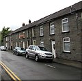
Anderson Terrace, Tonypandy
A row of four houses on the north side of St Andrew's Church.
Image: © Jaggery
Taken: 21 Sep 2017
0.01 miles
2
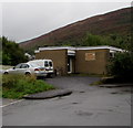
Trottsco office, De Winton Fields, Tonypandy
Roofing and scaffolding business.
Image: © Jaggery
Taken: 21 Sep 2017
0.01 miles
3
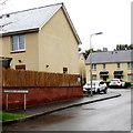
Houses on the east side of Gilmour Street, Tonypandy
Looking north from the corner of Church Street.
Image: © Jaggery
Taken: 21 Sep 2017
0.03 miles
4
Anderson Terrace, Tonypandy
A row of four houses located about 60 metres west of the Rhondda Fawr river.
Image: © Jaggery
Taken: 28 Oct 2011
0.04 miles
5
Cambrian Roofing Ltd, Tonypandy
Located on the west bank of the Rhondda Fawr river, opposite Anderson Terrace. http://www.geograph.org.uk/photo/2675130
Image: © Jaggery
Taken: 28 Oct 2011
0.04 miles
6
Tonypandy Health Centre
Located at De Winton Field, on the west bank of the Rhondda Fawr river.
Image: © Jaggery
Taken: 28 Oct 2011
0.04 miles
7
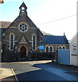
St Andrew's Church, Tonypandy
Located at the eastern end of Church Street. St Andrew's is a Church in Wales church in the parish of Tonypandy, diocese of Llandaff.
Image: © Jaggery
Taken: 28 Oct 2011
0.04 miles
8
Tonypandy Health Centre
National Health Service centre located in De Winton Field.
Image: © Jaggery
Taken: 21 Sep 2017
0.04 miles
9
Welsh-only name sign, Caeau De Winton, Tonypandy
Caeau is Welsh for fields. De usually means south in Welsh, but not here.
The De Winton family of Brecon were formerly major landowners in the Rhondda.
De Winton Street and the De Winton pub http://www.geograph.org.uk/photo/5551351 are nearby.
Image: © Jaggery
Taken: 21 Sep 2017
0.05 miles
10
St Andrew's Court, Tonypandy
The Church Street side of flats on the corner of Gilmour Street.
Image: © Jaggery
Taken: 21 Sep 2017
0.05 miles


