1
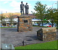
Sculpture of a miner and his family, Llwynypia
The sculpture of a coal miner and his family was erected by the Rhondda Civic Society to commemorate the mining communities of Rhondda. It was unveiled by Viscount Tonypandy on October 14th 1993.
The smaller brick structure facing the sculpture shows the location of all the mines in the Rhondda.
Image: © Jaggery
Taken: 28 Oct 2011
0.07 miles
2
Entrance to Tonypandy Enterprise Centre
Viewed across Llwynypia Road, Llwynypia.
Image: © Jaggery
Taken: 28 Oct 2011
0.08 miles
3
Tonypandy Powerhouse
Built in 1905, the Tonypandy Powerhouse became the engine house of the Llwynypia pit, and five years later became the starting point of the Tonypandy riots.
It was damaged during those riots after lock-out notices were issued to miners after they refused pay cuts in August of that year. Three months later an official strike began by all those employed by the Cambrian Combine.
The riots broke out in the area of the Powerhouse and windows were smashed. There was also rioting in Dunraven Street and Pandy Square in Tonypandy on the same day.
By 7 November, work at all the Cambrian Combine collieries had stopped, with the exception of the Llwynypia pit.
Image: © Kev Griffin
Taken: 15 Nov 2004
0.10 miles
4
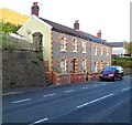
Llwynypia houses near the corner of Institute Place
Two semi-detached houses across Llwynypia Road. The steps on the left lead up to the statue of Archibald Hood. http://www.geograph.org.uk/photo/2676072
Image: © Jaggery
Taken: 28 Oct 2011
0.11 miles
5
Ordnance Survey Cut Mark
This OS cut mark can be found on the school wall east side of School Terrace. It marks a point 175.544m above mean sea level.
Image: © Adrian Dust
Taken: 13 May 2017
0.13 miles
6
CMB Service & Repair Centre, Llwynypia
Located on Llwynypia Road. Services available include MOT vehicle testing; car services and repairs; tyres; cars bought and sold.
Image: © Jaggery
Taken: 28 Oct 2011
0.13 miles
7
Unnamed side road, Llwynypia
Ascending from the A4058 Llwynypia Road. The sign on the right shows
ACCESS TO LLWYNYPIA TERRACE ROSEDALE TERRACE
ARGYLE TERRACE GRANGE TERRACE & HOLYROOD TERRACE.
Image: © Jaggery
Taken: 2 Oct 2017
0.13 miles
8
Ordnance Survey Cut Mark
This OS cut mark can be found on the wall west side of Llwynypia Road. It marks a point 144.344m above mean sea level.
Image: © Adrian Dust
Taken: 13 May 2017
0.14 miles
9
Row of houses behind Llwynypia Road, Llwynypia
Set back from the west side of the A4058 Llwynypia Road.
Image: © Jaggery
Taken: 2 Oct 2017
0.14 miles
10
McDonald's Llwynypia
Located below the east side of the A4058 Llwynypia Road.
Image: © Jaggery
Taken: 2 Oct 2017
0.14 miles


