
IMAGES TAKEN NEAR TO
Institute Road, TONYPANDY, CF40 2EZ
Introduction
This page details the photographs taken nearby to Institute Road, CF40 2EZ by members of the Geograph project.
The Geograph project started in 2005 with the aim of publishing, organising and preserving representative images for every square kilometre of Great Britain, Ireland and the Isle of Man.

There are currently over 7.5m images from over14,400 individuals and you can help contribute to the project by visiting https://www.geograph.org.uk
Image Map
Images are licensed for reuse under creativecommons.org/licenses/by-sa/2.0
Notes
- Clicking on the map will re-center to the selected point.
- The higher the marker number, the further away the image location is from the centre of the postcode.
Image Listing (107 Images Found)
Images are licensed for reuse under creativecommons.org/licenses/by-sa/2.0
Image
Details
Distance
1
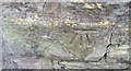
Ordnance Survey Cut Mark
This OS cut mark can be found on the school wall east side of School Terrace. It marks a point 175.544m above mean sea level.
Image: © Adrian Dust
Taken: 13 May 2017
0.03 miles
2
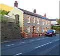
Llwynypia houses near the corner of Institute Place
Two semi-detached houses across Llwynypia Road. The steps on the left lead up to the statue of Archibald Hood. http://www.geograph.org.uk/photo/2676072
Image: © Jaggery
Taken: 28 Oct 2011
0.04 miles
3
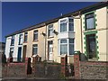
School Terrace
Row of terraced housing in Tonypandy.
Image: © Alan Hughes
Taken: 11 Apr 2019
0.07 miles
4
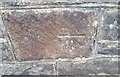
Ordnance Survey Cut Mark
This OS cut mark can be found on the wall west side of Llwynypia Road. It marks a point 144.344m above mean sea level.
Image: © Adrian Dust
Taken: 13 May 2017
0.08 miles
5
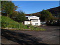
Cambrian N.U.M Club, Llwynypia
National Union of Miners club and institute, set below the east side of Llwynypia Road.
Image: © Jaggery
Taken: 28 Oct 2011
0.08 miles
6
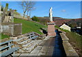
Archibald Hood statue, Llwynypia
Located in a viewing and seating area several metres above the west side of Llwynypia Road. Archibald Hood (1823-1902) was a Scottish mining engineer and entrepreneur. In 1862 Hood began operations in the Welsh coalfields, establishing the Glamorgan Coal Company, modernising and extending old pits and opening new ones. The colliery occupied an area from the Powerhouse, north of Tonypandy, to the Hay Stores in Llwynypia.
Archibald Hood’s concern and care for his workers was legendary. The inscription on the base of the statue is
ARCHIBALD HOOD
COAL OWNER
THIS STATUE IS ERECTED
BY HIS WORKMEN AND FRIENDS
AS A TOKEN OF RESPECT
TO HIS MEMORY
1906.
Image: © Jaggery
Taken: 28 Oct 2011
0.08 miles
7
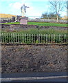
Archibald Hood statue viewed from Llwynypia Road, Llwynypia
Archibald Hood http://www.geograph.org.uk/photo/2676072 was a well-respected mine owner.
Image: © Jaggery
Taken: 28 Oct 2011
0.08 miles
8
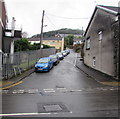
Unnamed side road in Llwynypia
Ascending from Llwynypia Road towards Ayton Terrace, De Winton Terrace and Llewellyn Terrace.
Image: © Jaggery
Taken: 21 Sep 2017
0.09 miles
9
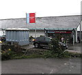
Kwik Save electricity substation, Llwynypia
In September 2017, the Western Power Distribution electricity substation is near Home Bargains discount store. The substation identifier KWIK SAVE S/S No. 54-1897 shows the name of the store when the substation was installed. Kwik Save ceased trading nationwide in 2007.
Image: © Jaggery
Taken: 21 Sep 2017
0.10 miles
10

Home Bargains, Llwynypia
Discount store viewed across Llwynypia Road in Llwynypia near the Tonypandy boundary.
Image: © Jaggery
Taken: 21 Sep 2017
0.10 miles