1
Ordnance Survey Cut Mark
This OS cut mark can be found on No91 Thomas Street. It marks a point 184.694m above mean sea level.
Image: © Adrian Dust
Taken: 13 May 2017
0.04 miles
2
Waun Road, Tonypandy
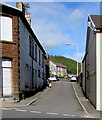
Ascending towards Thomas Street and Charles Street from the north side of Court Street.
Image: © Jaggery
Taken: 5 Oct 2017
0.05 miles
3
North along Davies Street, Tonypandy
Davies Street ascends from Court Street towards Thomas Street.
Image: © Jaggery
Taken: 5 Oct 2017
0.07 miles
4
Ordnance Survey Cut Mark
This OS cut mark can be found on the east face of the derelict PH. It marks a point 169.832m above mean sea level.
Image: © Adrian Dust
Taken: 13 May 2017
0.08 miles
5
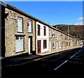
Long row of houses, Court Street, Tonypandy
From the corner of Waun Road, Court Street descends towards the centre of Tonypandy.
An old-style enamel street name sign is on the wall near the satellite dish on the left.
Image: © Jaggery
Taken: 5 Oct 2017
0.08 miles
6
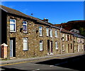
Houses and satellite dishes, Court Street, Tonypandy
On the north side of Court Street on the descent to the centre of Tonypandy.
Image: © Jaggery
Taken: 5 Oct 2017
0.08 miles
7
Entrance to the Monkey, Court Street, Tonypandy
The name sign http://www.geograph.org.uk/photo/5567348 shows MID RHONDDA WORKMEN'S CLUB ("THE MONKEY").
Image: © Jaggery
Taken: 5 Oct 2017
0.08 miles
8
Mid Rhondda Workmen's Club (The Monkey) name sign, Tonypandy
On a wall bracket here. http://www.geograph.org.uk/photo/5567347
Image: © Jaggery
Taken: 5 Oct 2017
0.08 miles
9
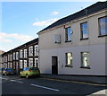
Derelict building, Court Street, Tonypandy
Windows and doors are boarded up on the Court Street and Davies Street sides of the building in October 2017. An August 2012 Google Earth Street View is similar apart from the absence of the dark green BT telecoms cabinet.
Image: © Jaggery
Taken: 5 Oct 2017
0.08 miles
10
King George VI postbox in a Court Street wall, Tonypandy
On the left here. http://www.geograph.org.uk/photo/5567363
Image: © Jaggery
Taken: 5 Oct 2017
0.08 miles


