
IMAGES TAKEN NEAR TO
Crawshay Road, TONYPANDY, CF40 1TE
Introduction
This page details the photographs taken nearby to Crawshay Road, CF40 1TE by members of the Geograph project.
The Geograph project started in 2005 with the aim of publishing, organising and preserving representative images for every square kilometre of Great Britain, Ireland and the Isle of Man.

There are currently over 7.5m images from over14,400 individuals and you can help contribute to the project by visiting https://www.geograph.org.uk
Image Map
Images are licensed for reuse under creativecommons.org/licenses/by-sa/2.0
Notes
- Clicking on the map will re-center to the selected point.
- The higher the marker number, the further away the image location is from the centre of the postcode.
Image Listing (86 Images Found)
Images are licensed for reuse under creativecommons.org/licenses/by-sa/2.0
Image
Details
Distance
1
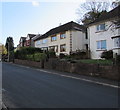
Vicarage Road houses, Penygraig
On the south side of the road, east of Vicarage Close.
Image: © Jaggery
Taken: 17 Oct 2017
0.06 miles
2
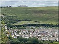
Brith-Weunydd above Trealaw
View across Trealaw and the Rhondda Fawr towards Brith-Weunydd and Mynydd Troed-y-Rhiw.
Image: © Alan Hughes
Taken: 6 Jul 2020
0.07 miles
3
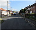
Broadfield Close, Penygraig
Cul-de-sac on the south side of Vicarage Road.
Image: © Jaggery
Taken: 17 Oct 2017
0.09 miles
4
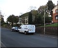
Tremorfa van, Vicarage Road, Penygraig
Based in The Terrace Suite, St Mellons Hotel, Castleton near Cardiff,
Tremorfa's business is engineering design, installation & maintenance.
Image: © Jaggery
Taken: 17 Oct 2017
0.10 miles
5
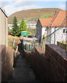
Steps down from Vicarage Road, Penygraig
Descending towards a path to Broadfield Close. The green cabinet is an electricity substation http://www.geograph.org.uk/photo/5572584
Image: © Jaggery
Taken: 17 Oct 2017
0.11 miles
6
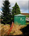
Broadfield Close electricity substation, Penygraig
The green cabinet is a Western Power Distribution electricity substation
located at the western end of Broadfield Close, opposite a path from Vicarage Road.
Image: © Jaggery
Taken: 17 Oct 2017
0.12 miles
7
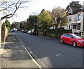
East along Vicarage Road, Penygraig
The broken white lines ahead on the left are at the Vicarage Close http://www.geograph.org.uk/photo/5572521 junction.
Image: © Jaggery
Taken: 17 Oct 2017
0.12 miles
8
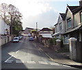
Up Park Road, Penygraig
From the south side of Vicarage Road, Park Road ascends towards Belle Vue Park.
Image: © Jaggery
Taken: 17 Oct 2017
0.14 miles
9
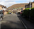
Vicarage Close, Penygraig
Cul-de-sac on the north side of Vicarage Road.
Image: © Jaggery
Taken: 17 Oct 2017
0.15 miles
10
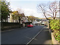
West along Vicarage Road, Penygraig
The car is near the corner of Park Road. http://www.geograph.org.uk/photo/5572493
Image: © Jaggery
Taken: 17 Oct 2017
0.15 miles