1
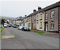
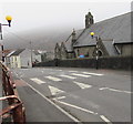
Unnamed side road in Penrhiwfer
Descending from the east side of the B4278 Penrhiwfer Road.
Image: © Jaggery
Taken: 3 Nov 2017
0.01 miles
2
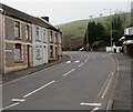
Ashdale Road, Penrhiwfer
Descending from Penrhiwfer Road. St Illtyd's Church http://www.geograph.org.uk/photo/5589558 is on the left.
Image: © Jaggery
Taken: 3 Nov 2017
0.03 miles
3
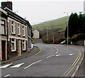
Up Ashdale Road, Penrhiwfer
Ashdale Road ascends towards the B4278 Penrhiwfer Road.
Image: © Jaggery
Taken: 3 Nov 2017
0.03 miles
4
End of cycle route - cyclists dismount, Penrhiwfer
On the approach to Ashdale Road.
Image: © Jaggery
Taken: 3 Nov 2017
0.03 miles
5
Oakley Terrace, Penrhiwfer
Row of houses on the east side of the B4278 Penrhiwfer Road.
Image: © Jaggery
Taken: 3 Nov 2017
0.04 miles
6
Penrhiwfer Road speed bumps, Penrhiwfer
Painted white triangles draw attention to the bumps across the B4278 Penrhiwfer Road opposite Oakley Terrace.
Image: © Jaggery
Taken: 3 Nov 2017
0.04 miles
7
Penrhiwfer Community Centre, Penrhiwfer
On the corner of Penrhiwfer Road and Ashdale Road.
Image: © Jaggery
Taken: 3 Nov 2017
0.04 miles
8
Increase in the speed limit, Penrhiwfer Road, Penrhiwfer
The 20mph speed limit on the B4278 Penrhiwfer Road increases to 30mph.
Image: © Jaggery
Taken: 3 Nov 2017
0.04 miles
9
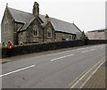
St Illtyd's Church, Williamstown
Church in Wales church in the Diocese of Llandaff viewed across the B4278 Penrhiwfer Road.
Though the church is known as St Illtyd's Church Williamstown, it is located
in Penrhiwfer south of Williamstown. The building was erected in the 1890s.
Image: © Jaggery
Taken: 3 Nov 2017
0.05 miles
10
Zebra crossing on a hump, Penrhiwfer Road, Penrhiwfer
Painted white triangles draw attention to the zebra crossing on a hump.
St Illtyd's Church http://www.geograph.org.uk/photo/5589558 is on the right.
Image: © Jaggery
Taken: 3 Nov 2017
0.05 miles


