
IMAGES TAKEN NEAR TO
Railway View, TONYPANDY, CF40 1RF
Introduction
This page details the photographs taken nearby to Railway View, CF40 1RF by members of the Geograph project.
The Geograph project started in 2005 with the aim of publishing, organising and preserving representative images for every square kilometre of Great Britain, Ireland and the Isle of Man.

There are currently over 7.5m images from over14,400 individuals and you can help contribute to the project by visiting https://www.geograph.org.uk
Image Map
Images are licensed for reuse under creativecommons.org/licenses/by-sa/2.0
Notes
- Clicking on the map will re-center to the selected point.
- The higher the marker number, the further away the image location is from the centre of the postcode.
Image Listing (156 Images Found)
Images are licensed for reuse under creativecommons.org/licenses/by-sa/2.0
Image
Details
Distance
1
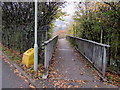
Path from Railway View towards a footbridge, Williamstown
The footbridge ahead over the A4119 leads to Arthur Street.
Image: © Jaggery
Taken: 3 Nov 2017
0.02 miles
2
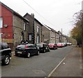
Railway View, Williamstown
Dead-end street connecting with the B4278 Penrhiwfer Road behind the camera.
Image: © Jaggery
Taken: 3 Nov 2017
0.02 miles
3
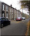
Northwest end of Railway View, Williamstown
Railway View ends at a fence above the B4278.
Image: © Jaggery
Taken: 3 Nov 2017
0.02 miles
4
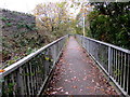
Footpath towards a footbridge, Williamstown
From Arthur Street towards Railway View via a footbridge over the A4119.
Image: © Jaggery
Taken: 3 Nov 2017
0.02 miles
5
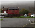
Rooftop solar panels on a Railway View house, Williamstown
Low cloud shrouds the distant hills on November 3rd 2017.
Image: © Jaggery
Taken: 3 Nov 2017
0.03 miles
6
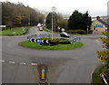
Crossroads roundabout in Williamstown
In the middle of the B4278 and A4119 crossroads.
Image: © Jaggery
Taken: 3 Nov 2017
0.03 miles
7

All Creased Up in Williamstown
Ironing services business viewed across Railway View. Spick & Span (valeting services) is on the right.
Image: © Jaggery
Taken: 3 Nov 2017
0.04 miles
8
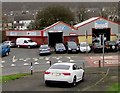
Penrhiwfer Road businesses in Williamstown
From left to right, names in view on November 3rd 2017 are All Creased Up (on the corner of Railway View), Spick & Span Autocare and Valeting Services, Penrhiwfer Motors.
Image: © Jaggery
Taken: 3 Nov 2017
0.05 miles
9
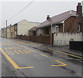
Arthur Street bungalow, Williamstown
Viewed from the corner of Caroline Street.
Image: © Jaggery
Taken: 26 Oct 2017
0.05 miles
10
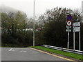
A4119 distances from Williamstown
Signs at the B4278 junction show Tonypandy 2 (miles) Edmondstown ½ Penygraig ½ Dinas 1½ Porth 2¼.
The upper circular sign sign indicates Clearway (no stopping or parking).
The lower circular sign indicates No Pedestrians.
Image: © Jaggery
Taken: 3 Nov 2017
0.05 miles