IMAGES TAKEN NEAR TO
Dinas Isaf Industrial Estate West, TONYPANDY, CF40 1PY

Introduction

This page details the photographs taken nearby to Dinas Isaf Industrial Estate West, CF40 1PY by members of the Geograph project.

The Geograph project started in 2005 with the aim of publishing, organising and preserving representative images for every square kilometre of Great Britain, Ireland and the Isle of Man.

There are currently over 7.5m images from over14,400 individuals and you can help contribute to the project by visiting https://www.geograph.org.uk

Image Map


Images are licensed for reuse under creativecommons.org/licenses/by-sa/2.0
Notes
  • Clicking on the map will re-center to the selected point.
  • The higher the marker number, the further away the image location is from the centre of the postcode.

Image Listing (44 Images Found)

Images are licensed for reuse under creativecommons.org/licenses/by-sa/2.0
  • ...
Image
Details
Distance
1
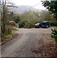
Parking area, Office Row, Penrhiwfer
Near the entrance to Pantile Motor Works. https://www.geograph.org.uk/photo/5934873
Image: © Jaggery Taken: 3 Nov 2017
0.07 miles
2
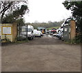
Entrance to Pantile Motor Works, Office Row, Penrhiwfer
Premises of E.T.Davies vehicle breakers & dismantlers.
Image: © Jaggery Taken: 3 Nov 2017
0.07 miles
3
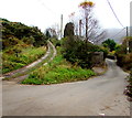
Junction in Penrhiwfer
Left fork for Lewis Arms Row houses. Right fork for Office Row houses.
Image: © Jaggery Taken: 3 Nov 2017
0.08 miles
4
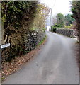
Office Row name sign, Penrhiwfer
On the southern approach to these houses. https://www.geograph.org.uk/photo/5934899
Image: © Jaggery Taken: 3 Nov 2017
0.08 miles
5
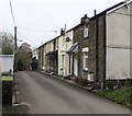
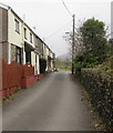
South along Office Row, Penrhiwfer
Row of houses extending for 35 metres.
Image: © Jaggery Taken: 3 Nov 2017
0.09 miles
6
North along Office Row, Penrhiwfer
Row of houses extending for 35 metres.
Image: © Jaggery Taken: 3 Nov 2017
0.10 miles
7
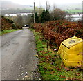
Yellow grit/salt box, Penrhiwfer
Alongside this https://www.geograph.org.uk/photo/5934834 unclassified road.
Image: © Jaggery Taken: 3 Nov 2017
0.12 miles
8
Mynydd Y Dinas to Tonyrefail
Image: © Anthony John Taken: 30 Oct 2006
0.12 miles
9
Lewis Arms Row houses, Penrhiwfer
Office Row houses are nearby. https://www.geograph.org.uk/photo/5934913
Image: © Jaggery Taken: 3 Nov 2017
0.13 miles
10
Unclassified road descending from the B4278 in Penrhiwfer
Descending from the east side of the B4278 Penrhiwfer Road towards Office Row and Lewis Arms Row.
Image: © Jaggery Taken: 3 Nov 2017
0.13 miles
  • ...