IMAGES TAKEN NEAR TO
Greenfield Street, TONYPANDY, CF40 1PN
Introduction
This page details the photographs taken nearby to Greenfield Street, CF40 1PN by members of the Geograph project.
The Geograph project started in 2005 with the aim of publishing, organising and preserving representative images for every square kilometre of Great Britain, Ireland and the Isle of Man.

There are currently over 7.5m images from over14,400 individuals and you can help contribute to the project by visiting https://www.geograph.org.uk
Image Map
Images are licensed for reuse under creativecommons.org/licenses/by-sa/2.0
Notes
- Clicking on the map will re-center to the selected point.
- The higher the marker number, the further away the image location is from the centre of the postcode.
Image Listing (191 Images Found)
Images are licensed for reuse under creativecommons.org/licenses/by-sa/2.0
Image
Details
Distance
1
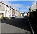
Library Road, Penygraig
From Amos Hill, Library Road ascends towards Belle Vue Park.
Image: © Jaggery
Taken: 20 Oct 2017
0.04 miles
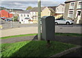
2
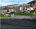
Towards Amos Hill, Penygraig
Viewed from the corner of the B4278 and Pleasant Road looking towards Amos Hill houses.
Image: © Jaggery
Taken: 20 Oct 2017
0.04 miles
3
Amos Hill, Penygraig
Ascending from the corner of Swan Terrace.
Image: © Jaggery
Taken: 20 Oct 2017
0.04 miles
4
Up Amos Hill, Penygraig
The sign on the left warns that the Amos Hill roadway narrows ahead.
Image: © Jaggery
Taken: 20 Oct 2017
0.06 miles
6
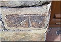
Ordnance Survey Cut Mark
This OS cut mark can be found on No80 Amos Hill. It marks a point 172.907m above mean sea level.
Image: © Adrian Dust
Taken: 21 May 2017
0.06 miles
7
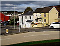
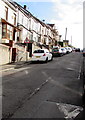
Houses at the bottom of Amos Hill, Penygraig
Between Library Road and Swan Terrace.
Image: © Jaggery
Taken: 20 Oct 2017
0.06 miles
8
Zebra crossing, Swan Terrace, Penygraig
At the SW end of Swan Terrace. Although Belisha beacons had marked pedestrian crossings in the UK from 1934, it was not until 1951 that black and white stripes across the width of the road were officially introduced. Previously, there were only metal studs across the road surface.
Image: © Jaggery
Taken: 20 Oct 2017
0.07 miles
9
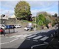
Zebra crossing, Swan Terrace, Penygraig
Across Swan Terrace to Swan Terrace Car Park.
Image: © Jaggery
Taken: 20 Oct 2017
0.07 miles
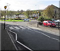
10
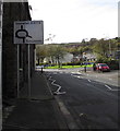
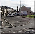
Directions sign facing Swan Terrace, Penygraig
On the approach to the roundabout at the B4278 junction.
Image: © Jaggery
Taken: 20 Oct 2017
0.07 miles