
IMAGES TAKEN NEAR TO
Coronation Street, TONYPANDY, CF40 1PA
Introduction
This page details the photographs taken nearby to Coronation Street, CF40 1PA by members of the Geograph project.
The Geograph project started in 2005 with the aim of publishing, organising and preserving representative images for every square kilometre of Great Britain, Ireland and the Isle of Man.

There are currently over 7.5m images from over14,400 individuals and you can help contribute to the project by visiting https://www.geograph.org.uk
Image Map
Images are licensed for reuse under creativecommons.org/licenses/by-sa/2.0
Notes
- Clicking on the map will re-center to the selected point.
- The higher the marker number, the further away the image location is from the centre of the postcode.
Image Listing (145 Images Found)
Images are licensed for reuse under creativecommons.org/licenses/by-sa/2.0
Image
Details
Distance
1
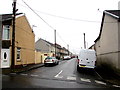
Blanche Street, Williamstown
From Caroline Street along Blanche Street towards Coronation Street and School Street.
Some maps show Blanch Street.
Image: © Jaggery
Taken: 26 Oct 2017
0.02 miles
2
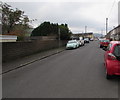
Blanche Street, Williamstown
From School Street along Blanche Street towards Coronation Street and Caroline Street.
Image: © Jaggery
Taken: 31 Oct 2017
0.02 miles
3
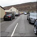
Up Coronation Street, Williamstown
Coronation Street ascends from Arthur Street to Blanche Street.
Image: © Jaggery
Taken: 31 Oct 2017
0.03 miles
4
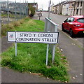
Williamstown bilingual street name sign
In October 2017 the sign on the corner of Arthur Street shows that Coronation Street is Stryd y Coroni in Welsh.
A September 2012 Google Earth Street View shows an English-only street name sign here.
Image: © Jaggery
Taken: 31 Oct 2017
0.03 miles
5
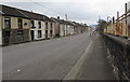
Long straight part of Arthur Street, Williamstown
The houses on the left are opposite the site formerly occupied by
Williamstown Primary School. The school buildings have been demolished.
Image: © Jaggery
Taken: 31 Oct 2017
0.03 miles
6
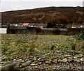
Site of the demolished former Williamstown Primary School, Williamstown
Viewed through Arthur Street railings in October 2017. The current school buildings are in Dinas Isaf West.
The old school buildings here were still standing and boarded up in a September 2012 Google Earth Street View.
Image: © Jaggery
Taken: 31 Oct 2017
0.04 miles
7
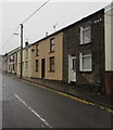
Arthur Street houses, Williamstown
Southeast of the Caroline Street junction.
Image: © Jaggery
Taken: 26 Oct 2017
0.04 miles
8
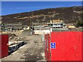
Building site at Williamstown
New houses under construction at Williamstown.
Image: © Alan Hughes
Taken: 11 Apr 2019
0.04 miles
9
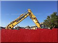
Komatsu digger
Mechanical excavator at work on building site.
Image: © Alan Hughes
Taken: 11 Apr 2019
0.04 miles
10
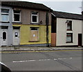
Chattels removal notices on an Arthur Street house, Williamstown
On October 31st 2017, estate agents' notices are on the front door and boarded-over window. Dated October 11th 2017, they state "Notice is hereby given that if chattels remaining herein are not removed by appointment with the Agent, detailed below, within 7 days of the date of this notice, the Agents shall be entitled to dispose of the said chattels in an appropriate manner, at their discretion." Chattels are movable possessions.
Image: © Jaggery
Taken: 31 Oct 2017
0.04 miles