1
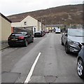
Up Coronation Street, Williamstown
Coronation Street ascends from Arthur Street to Blanche Street.
Image: © Jaggery
Taken: 31 Oct 2017
0.01 miles
2
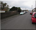
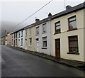
Blanche Street, Williamstown
From Caroline Street along Blanche Street towards Coronation Street and School Street.
Some maps show Blanch Street.
Image: © Jaggery
Taken: 26 Oct 2017
0.02 miles
3
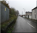
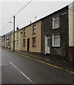
Blanche Street, Williamstown
From School Street along Blanche Street towards Coronation Street and Caroline Street.
Image: © Jaggery
Taken: 31 Oct 2017
0.02 miles
4
SE along Mountain Road, Williamstown
Looking to the southeast along Mountain Road.
The edge of this http://www.geograph.org.uk/photo/5580775 Western Power Distribution electricity substation is on the left.
Image: © Jaggery
Taken: 26 Oct 2017
0.04 miles
5
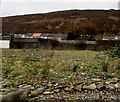
Site of the demolished former Williamstown Primary School, Williamstown
Viewed through Arthur Street railings in October 2017. The current school buildings are in Dinas Isaf West.
The old school buildings here were still standing and boarded up in a September 2012 Google Earth Street View.
Image: © Jaggery
Taken: 31 Oct 2017
0.05 miles
6
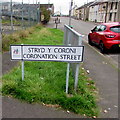
Williamstown bilingual street name sign
In October 2017 the sign on the corner of Arthur Street shows that Coronation Street is Stryd y Coroni in Welsh.
A September 2012 Google Earth Street View shows an English-only street name sign here.
Image: © Jaggery
Taken: 31 Oct 2017
0.06 miles
7
Long straight part of Arthur Street, Williamstown
The houses on the left are opposite the site formerly occupied by
Williamstown Primary School. The school buildings have been demolished.
Image: © Jaggery
Taken: 31 Oct 2017
0.06 miles
8
Arthur Street houses, Williamstown
Southeast of the Caroline Street junction.
Image: © Jaggery
Taken: 26 Oct 2017
0.06 miles
9
Row of houses, Caroline Street, Williamstown
Extending for 30 metres to the corner of Blanche Street.
Image: © Jaggery
Taken: 26 Oct 2017
0.06 miles
10
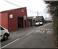
K&P Autoservices in Williamstown
Mountain Road garage near the corner of School Street.
Image: © Jaggery
Taken: 31 Oct 2017
0.06 miles


