IMAGES TAKEN NEAR TO
Dinas Isaf Industrial Estate, TONYPANDY, CF40 1NY

Introduction

This page details the photographs taken nearby to Dinas Isaf Industrial Estate, CF40 1NY by members of the Geograph project.

The Geograph project started in 2005 with the aim of publishing, organising and preserving representative images for every square kilometre of Great Britain, Ireland and the Isle of Man.

There are currently over 7.5m images from over14,400 individuals and you can help contribute to the project by visiting https://www.geograph.org.uk

Image Map


Images are licensed for reuse under creativecommons.org/licenses/by-sa/2.0
Notes
  • Clicking on the map will re-center to the selected point.
  • The higher the marker number, the further away the image location is from the centre of the postcode.

Image Listing (70 Images Found)

Images are licensed for reuse under creativecommons.org/licenses/by-sa/2.0
  • ...
Image
Details
Distance
1
Across the Rhondda from Penrhiwfer
This view is toward Mynydd Dinas from a footpath leading down from Lewi Arms Row.
Image: © Mick Lobb Taken: 25 Sep 2008
0.06 miles
2
Valley view from an Edmondstown corner
Towards the valley of the Ely River from the corner of Weston Terrace and Rhys Street in Edmondstown.
Image: © Jaggery Taken: 31 Oct 2017
0.08 miles
3
Home ground of Penrhiwfer AFC
Penrhiwfer AFC (Association Football Club) plays home matches here, on the Queen Elizabeth II Field located on flat land in the valley of the Ely River. https://www.geograph.org.uk/photo/5934987 to a broader view.
Image: © Jaggery Taken: 3 Nov 2017
0.10 miles
4
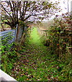
Gate to a track towards Williamstown Primary School
The gate gives walkers access to this https://www.geograph.org.uk/photo/5934947 grassy track.
Image: © Jaggery Taken: 3 Nov 2017
0.12 miles
5
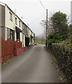
North along Office Row, Penrhiwfer
Row of houses extending for 35 metres.
Image: © Jaggery Taken: 3 Nov 2017
0.12 miles
6
Grassy track north from Lewis Arms Row, Penrhiwfer
Towards Williamstown Primary School, viewed from this https://www.geograph.org.uk/photo/5934951 gate.
Image: © Jaggery Taken: 3 Nov 2017
0.12 miles
7
Lewis Arms Row name sign, Penrhiwfer
At the eastern edge of these houses. https://www.geograph.org.uk/photo/5934934
Image: © Jaggery Taken: 3 Nov 2017
0.12 miles
8
Road towards Lewis Arms Row, Penrhiwfer
Ascending from Office Row.
Image: © Jaggery Taken: 3 Nov 2017
0.12 miles
9
Lewis Arms Row houses, Penrhiwfer
Office Row houses are nearby. https://www.geograph.org.uk/photo/5934913
Image: © Jaggery Taken: 3 Nov 2017
0.13 miles
10
Rhys Street bungalows, Edmondstown
On the right here. http://www.geograph.org.uk/photo/5585438
Image: © Jaggery Taken: 31 Oct 2017
0.13 miles
  • ...