1
Steep ascent from Tylacelyn Road, Penygraig
An unnamed side street ascends from Tylacelyn Road to Hughes Street.
Image: © Jaggery
Taken: 17 Oct 2017
0.03 miles
2
Tylacelyn Road near Penygraig
The view along Tylacelyn Road towards Tonypandy.
Image: © Martyn Harries
Taken: 6 Aug 2011
0.04 miles
3
Penygraig RFC
Penygraig Rugby Football Club.
Image: © Alan Hughes
Taken: 11 Apr 2019
0.05 miles
4
On-street parking, Tylacelyn Road, Penygraig
Parking allowed on the west side of the road.
Double yellow lines on the east side indicate no parking at any time.
The corner of an unnamed side street http://www.geograph.org.uk/photo/5577040 is on the left.
Image: © Jaggery
Taken: 17 Oct 2017
0.05 miles
5
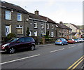
Tylacelyn Road houses, Penygraig
On the west side of Tylacelyn Road. Penygraig RFC clubhouse http://www.geograph.org.uk/photo/5576993 is on the right.
Image: © Jaggery
Taken: 17 Oct 2017
0.05 miles
6
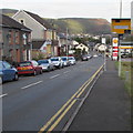
Yellow speed camera, Tylacelyn Road, Penygraig
Facing northbound traffic (towards Tonypandy).
Image: © Jaggery
Taken: 17 Oct 2017
0.05 miles
7
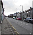
Up Tylacelyn Road, Penygraig
Part of Tylacelyn Road's long ascent away from the Rhondda River (Afon Rhondda Fawr in Welsh).
Image: © Jaggery
Taken: 17 Oct 2017
0.05 miles
8
Penygraig RFC clubhouse, Penygraig
On the west side of Tylacelyn Road, opposite the entrance http://www.geograph.org.uk/photo/5576974
to Graig Park where Penygraig RFC (Rugby Football Club) play home matches.
Image: © Jaggery
Taken: 17 Oct 2017
0.06 miles
9
Penygraig RFC crest, Penygraig
The Penygraig RFC (Rugby Football Club) crest is on the doorway here. http://www.geograph.org.uk/photo/5576993
Image: © Jaggery
Taken: 17 Oct 2017
0.06 miles
10
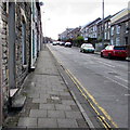
Pavement and doorsteps, Tylacelyn Road, Penygraig
On the west side of Tylacelyn Road on the long ascent from the Rhondda River (Afon Rhondda Fawr in Welsh).
Image: © Jaggery
Taken: 17 Oct 2017
0.06 miles


