1
Ordnance Survey Cut Mark
This inverted OS cut mark can be found on the school wall. It marks a point 174.480m above mean sea level.
Image: © Adrian Dust
Taken: 21 May 2017
0.03 miles
2
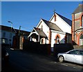
Church of SS Gabriel and Raphael, Tonypandy
Located on the corner of Trinity Road and Primrose Street.
The Roman Catholic SS (Saints) Gabriel and Raphael is the church for the Rhondda Parish, covering all of the Rhondda Fach and Rhondda Fawr except for Ynyshir. The building on the right is the presbytery. http://www.geograph.org.uk/photo/2668968
Image: © Jaggery
Taken: 28 Oct 2011
0.09 miles
3
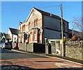
Presbytery, SS Gabriel and Raphael church, Tonypandy
The presbytery (priests' house) is on Trinity Road, next door to the church. http://www.geograph.org.uk/photo/2668962
Image: © Jaggery
Taken: 28 Oct 2011
0.09 miles
4
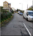
Primrose Street, Tonypandy
Houses at the SE end of Primrose Street, viewed from Trinity Road. The houses face a Roman Catholic church http://www.geograph.org.uk/photo/2668962 and school.
Image: © Jaggery
Taken: 28 Oct 2011
0.09 miles
5
Tonypandy Athletic Workingmen's Club and Institute
Located on the corner of Primrose Street and Derwydd Road, Tonypandy, opposite Mid Rhondda Central Working Men's Club. http://www.geograph.org.uk/photo/2669060
Image: © Jaggery
Taken: 28 Oct 2011
0.09 miles
6
The Welcome Inn, Tonypandy
Pub located at the junction of Dunraven Street and Tylacelyn Road.
Image: © Jaggery
Taken: 28 Oct 2011
0.12 miles
7
Corner of Adare Terrace and Dunraven Street, Tonypandy
No entry signs prevent vehicular access to Adare Terrace from Dunraven Street.
Image: © Jaggery
Taken: 28 Oct 2011
0.12 miles
8
Ordnance Survey Cut Mark
This OS cut mark can be found at the lane junction on Trinity Road. It marks a point 145.115m above mean sea level.
Image: © Adrian Dust
Taken: 13 May 2017
0.13 miles
9
Ordnance Survey Cut Mark
This OS cut mark can be found on the wall of the school on Kenry Street. It marks a point 160.898m above mean sea level.
Image: © Adrian Dust
Taken: 13 May 2017
0.13 miles
10
Hughes Street, Penygraig
Ascending from Tylacelyn Road.
Image: © Jaggery
Taken: 17 Oct 2017
0.14 miles


