IMAGES TAKEN NEAR TO
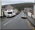
Graig-Ddu Road, TONYPANDY, CF40 1HS

Introduction

This page details the photographs taken nearby to Graig-Ddu Road, CF40 1HS by members of the Geograph project.

The Geograph project started in 2005 with the aim of publishing, organising and preserving representative images for every square kilometre of Great Britain, Ireland and the Isle of Man.

There are currently over 7.5m images from over14,400 individuals and you can help contribute to the project by visiting https://www.geograph.org.uk

Image Map


Images are licensed for reuse under creativecommons.org/licenses/by-sa/2.0
Notes
  • Clicking on the map will re-center to the selected point.
  • The higher the marker number, the further away the image location is from the centre of the postcode.

Image Listing (16 Images Found)

Images are licensed for reuse under creativecommons.org/licenses/by-sa/2.0
Image
Details
Distance
1
AFC Porth, Dinas Road
Image: © Roger Cornfoot Taken: 25 Apr 2007
0.17 miles
2
Dinas Road, Dinas
Image: © Roger Cornfoot Taken: 25 Apr 2007
0.17 miles
3
Marjorie Street, Trealaw
From the corner of Alaw Road along Marjorie Street towards the corner of Brynteg Terrace.
Image: © Jaggery Taken: 10 Oct 2017
0.19 miles
4
Brynteg Terrace, Trealaw
Brynteg Terrace descends from Brithweunydd Road towards New Century Street and Marjorie Street.
Image: © Jaggery Taken: 10 Oct 2017
0.19 miles
5
Four blocks of flats, Dinas Rhondda
Located between Pen Dinas and the A4058 Dinas Road, viewed from Marjorie Street in Trealaw.
Image: © Jaggery Taken: 10 Oct 2017
0.19 miles
6
Trealaw from Mynydd Dinas
Image: © Gareth James Taken: 2 Jan 2015
0.20 miles
7
View over the Rhondda Fawr valley from Mynydd Dinas
Image: © Gareth James Taken: 2 Jan 2015
0.21 miles
8
Pandy railway station (site), Rhondda Cynon Taf
Opened in 1861 by the Taff Vale Railway on the line that now runs from Cardiff to Treherbert, this railway station closed in 1886 when it was replaced by the current station of Dinas Rhondda, the platform of which is in the foreground. View south east towards Porth and Cardiff. The platforms at Pandy started from roughly where the signal now is. As built, Dinas Rhonda had a further two tracks and a platform to the right of the line shown. Pandy only had two tracks and it is likely the enforced shift 200m towards the camera was because there was no room to widen the track at Pandy station.
Image: © Nigel Thompson Taken: 13 Jun 2014
0.21 miles
9
View of the Rhondda Fawr
Looking over the valley from Mynydd Dinas. On the opposite side is the village of Trealaw, below Mynydd Brith-weunydd and Mynydd Troed-y-rhiw, immediately below is Dinas, with Tonypandy and Llwynypia and other settlements stretching away to the north.
Image: © Gareth James Taken: 2 Jan 2015
0.22 miles
10
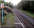
Rhondda Line from Dinas Rhondda towards Porth station
Viewed from the eastern end of the only platform at Dinas Rhondda station. http://www.geograph.org.uk/photo/5553175 The trees on the right are above the Rhondda River.
Image: © Jaggery Taken: 28 Sep 2017
0.22 miles