
IMAGES TAKEN NEAR TO
Parc Gellifaelog, TONYPANDY, CF40 1BF
Introduction
This page details the photographs taken nearby to Parc Gellifaelog, CF40 1BF by members of the Geograph project.
The Geograph project started in 2005 with the aim of publishing, organising and preserving representative images for every square kilometre of Great Britain, Ireland and the Isle of Man.

There are currently over 7.5m images from over14,400 individuals and you can help contribute to the project by visiting https://www.geograph.org.uk
Image Map
Images are licensed for reuse under creativecommons.org/licenses/by-sa/2.0
Notes
- Clicking on the map will re-center to the selected point.
- The higher the marker number, the further away the image location is from the centre of the postcode.
Image Listing (34 Images Found)
Images are licensed for reuse under creativecommons.org/licenses/by-sa/2.0
Image
Details
Distance
1
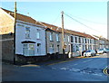
Primrose Street, Tonypandy
Houses at the SE end of Primrose Street, viewed from Trinity Road. The houses face a Roman Catholic church http://www.geograph.org.uk/photo/2668962 and school.
Image: © Jaggery
Taken: 28 Oct 2011
0.13 miles
2
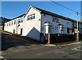
Tonypandy Athletic Workingmen's Club and Institute
Located on the corner of Primrose Street and Derwydd Road, Tonypandy, opposite Mid Rhondda Central Working Men's Club. http://www.geograph.org.uk/photo/2669060
Image: © Jaggery
Taken: 28 Oct 2011
0.13 miles
3
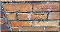
Ordnance Survey Cut Mark
This OS cut mark can be found on the wall of the school on Kenry Street. It marks a point 160.898m above mean sea level.
Image: © Adrian Dust
Taken: 13 May 2017
0.14 miles
4
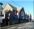
Tonypandy Primary School
Viewed across Primrose Street.
Image: © Jaggery
Taken: 28 Oct 2011
0.15 miles
5
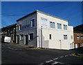
Mid Rhondda Central WMC, Tonypandy
Working men's club on the corner of Primrose Street and Derwydd Road. The large notice on the wall states that new members are welcome; function room for hire; skittles & darts; pool & snooker.
The club is opposite Tonypandy Athletic Workingmen's Club and Institute. http://www.geograph.org.uk/photo/2669070
Image: © Jaggery
Taken: 28 Oct 2011
0.15 miles
6
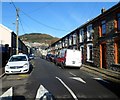
Tonypandy : Primrose Street houses north of the primary school
Viewed from a speed bump near Tonypandy Primary School. http://www.geograph.org.uk/photo/2669159
Image: © Jaggery
Taken: 28 Oct 2011
0.16 miles
7
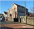
Presbytery, SS Gabriel and Raphael church, Tonypandy
The presbytery (priests' house) is on Trinity Road, next door to the church. http://www.geograph.org.uk/photo/2668962
Image: © Jaggery
Taken: 28 Oct 2011
0.19 miles
8
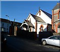
Church of SS Gabriel and Raphael, Tonypandy
Located on the corner of Trinity Road and Primrose Street.
The Roman Catholic SS (Saints) Gabriel and Raphael is the church for the Rhondda Parish, covering all of the Rhondda Fach and Rhondda Fawr except for Ynyshir. The building on the right is the presbytery. http://www.geograph.org.uk/photo/2668968
Image: © Jaggery
Taken: 28 Oct 2011
0.19 miles
9
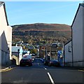
Gelli Road, Tonypandy
Viewed from Primrose Street. Gelli Road descends towards Eleanor Street and the pedestrianised shopping area in Dunraven Street.
Image: © Jaggery
Taken: 28 Oct 2011
0.19 miles
10
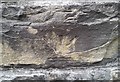
Ordnance Survey Cut Mark
This inverted OS cut mark can be found on the school wall. It marks a point 174.480m above mean sea level.
Image: © Adrian Dust
Taken: 21 May 2017
0.20 miles