1
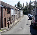
Clydach Vale
View along Cwm Clydach towards Tonypandy and in the direction of Porth and Pontypridd.
Image: © Alan Hughes
Taken: 11 Apr 2019
0.03 miles
2
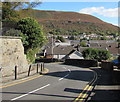
Chapel Street, Tonypandy
Dead end street extending for 60 metres from the south side of Court Street.
Image: © Jaggery
Taken: 5 Oct 2017
0.05 miles
3
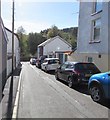
Houses on the north side of Court Street, Tonypandy
On the descent towards the centre of Tonypandy.
Image: © Jaggery
Taken: 5 Oct 2017
0.06 miles
4
The Pandy, Tonypandy
Pub located at the crossroads of De Winton Street, Llwynypia Road, Court Street and Church Street. Though not named as such on maps, this area is often referred to as Tonypandy Square or Pandy Square.
Image: © Jaggery
Taken: 28 Oct 2011
0.06 miles
5
Tonypandy Square shops
Viewed along De Winton Street looking towards The Pandy. http://www.geograph.org.uk/photo/2674608
Image: © Jaggery
Taken: 28 Oct 2011
0.06 miles
6
Tonypandy bus station
Viewed across Court Street.
Image: © Jaggery
Taken: 28 Oct 2011
0.06 miles
7
Bend in Court Street, Tonypandy
On the descent to the centre of Tonypandy. Double yellow lines on both sides indicate no parking at any time.
A white cross is on the distant hillside.
Image: © Jaggery
Taken: 5 Oct 2017
0.06 miles
8
South side of Davies Street, Tonypandy
One-way street, direction ahead.
Image: © Jaggery
Taken: 5 Oct 2017
0.06 miles
9
Brynamlwg, Park Place, Tonypandy
Brynamlwg is a row of five houses at the southern end of Park Place, on the corner of Gilfach Road.
Image: © Jaggery
Taken: 28 Oct 2011
0.06 miles
10
Nant Clydach emerges from a culvert, central Tonypandy
A few metres behind the camera, the brook Nant Clydach flows under De Winton Street at Pandy Bridge, on its way to the confluence with the Rhondda Fawr, about 200 metres away.
Image: © Jaggery
Taken: 28 Oct 2011
0.06 miles


