1
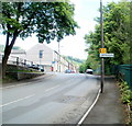
Heather Way
Image: © Colin Pyle
Taken: 4 Jan 2010
0.02 miles
2
Primrose Terrace
Image: © Colin Pyle
Taken: 4 Jan 2010
0.06 miles
3
Llwyncelyn Infant School, Porth
The school is located on the west side of Heather Way, Porth. There is no 's' after Infant in the name sign on the wall on the right.
Image: © Jaggery
Taken: 6 May 2011
0.10 miles
4
Church for sale in Llwyncelyn
Image: © Gareth James
Taken: 4 Apr 2015
0.10 miles
5
Boundary of Llwyncelyn, Porth
Looking towards Leslie Terrace in the Llwyncelyn district of Porth along a short, unnamed connecting road from Llwyncelyn Road.
Image: © Jaggery
Taken: 6 May 2011
0.12 miles
6
Meadbro, Porth
Meadbro Construction Ltd occupy unit 7, Llwyncelyn Industrial Estate in the east of Porth.
Image: © Jaggery
Taken: 6 May 2011
0.12 miles
7
Primrose Terrace, Llwyncelyn, Porth
The view ENE from the school end of the terrace.
Image: © Jaggery
Taken: 6 May 2011
0.12 miles
8
Proos Roofing Centres Ltd, Porth
Located on Llwyncelyn Industrial Estate, next door to Meadbro. http://www.geograph.org.uk/photo/2440726
Image: © Jaggery
Taken: 6 May 2011
0.13 miles
9
Beatus Cartons, Porth
Large factory in the east of Porth, adjacent to the fire station. http://www.geograph.org.uk/photo/2440629
Beatus Cartons make solid board, litho-laminated and plastic packaging.
Image: © Jaggery
Taken: 6 May 2011
0.13 miles
10
Leslie Terrace, Llwyncelyn, Porth
There are almost 100 houses in Leslie Terrace, in several rows. This row, near the centre, contains 21 houses numbered 56 to 36, in descending sequence away from the camera. There are no houses on the opposite side of the street.
The sign at the left points towards the Rhondda Fach Trail and National Cycle Network route 881. Distance shown, in miles, are Maerdy 7, Ynyshir 1, Porth railway station ½.
Image: © Jaggery
Taken: 6 May 2011
0.14 miles


