
IMAGES TAKEN NEAR TO
Leslie Terrace, PORTH, CF39 9TD
Introduction
This page details the photographs taken nearby to Leslie Terrace, CF39 9TD by members of the Geograph project.
The Geograph project started in 2005 with the aim of publishing, organising and preserving representative images for every square kilometre of Great Britain, Ireland and the Isle of Man.

There are currently over 7.5m images from over14,400 individuals and you can help contribute to the project by visiting https://www.geograph.org.uk
Image Map
Images are licensed for reuse under creativecommons.org/licenses/by-sa/2.0
Notes
- Clicking on the map will re-center to the selected point.
- The higher the marker number, the further away the image location is from the centre of the postcode.
Image Listing (84 Images Found)
Images are licensed for reuse under creativecommons.org/licenses/by-sa/2.0
Image
Details
Distance
1
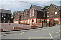
Llwyncelyn Infant School, Porth
The school is located on the west side of Heather Way, Porth. There is no 's' after Infant in the name sign on the wall on the right.
Image: © Jaggery
Taken: 6 May 2011
0.04 miles
3
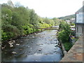
Pipeline over the River Rhondda, Porth
The view downstream from Eirw-uchaf Bridge. The pipeline is enclosed in a supporting structure.
Image: © Jaggery
Taken: 6 May 2011
0.06 miles
4
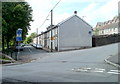
Leslie Terrace, Llwyncelyn, Porth
There are almost 100 houses in Leslie Terrace, in several rows. This row, near the centre, contains 21 houses numbered 56 to 36, in descending sequence away from the camera. There are no houses on the opposite side of the street.
The sign at the left points towards the Rhondda Fach Trail and National Cycle Network route 881. Distance shown, in miles, are Maerdy 7, Ynyshir 1, Porth railway station ½.
Image: © Jaggery
Taken: 6 May 2011
0.07 miles
5
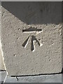
Ordnance Survey Cut Mark
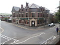
This OS cut mark can be found on the east angle of the Llwyncelyn Hotel. It marks a point 96.046m above mean sea level.
Image: © Adrian Dust
Taken: 18 Apr 2015
0.07 miles
8
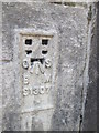
Ordnance Survey Flush Bracket (S1307)
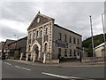
This OS Flush Bracket can be found on the east face of the Elim Pentecostal Church. It marks a point 94.052m above mean sea level.
Image: © Adrian Dust
Taken: 18 Apr 2015
0.10 miles
9
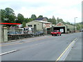
S&F Motors Ltd, Porth
Accident repair specialists, located on Pontypridd Road,near Eirw-uchaf Bridge over the River Rhondda.
Image: © Jaggery
Taken: 6 May 2011
0.11 miles
10
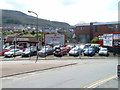
Chequered Flag, Porth
User car dealers' premises on Pontypridd Road.
Image: © Jaggery
Taken: 6 May 2011
0.11 miles