1
Ordnance Survey Cut Mark
This OS cut mark can be found on No32 Eirw Road. It marks a point 87.566m above mean sea level.
Image: © Adrian Dust
Taken: 27 May 2018
0.14 miles
2
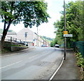
Eirw Road, Porth
Image: © Roger Cornfoot
Taken: 25 Apr 2007
0.14 miles
3
Eirw Road, Porth
Image: © Roger Cornfoot
Taken: 25 Apr 2007
0.15 miles
4
Remains of disused YMCA building, Porth
Rubble in a fenced-off site on the corner of River Terrace is the remains of a former YMCA building destroyed by fire in November 2008. The building was disused at the time of the fire.
Image: © Jaggery
Taken: 6 May 2011
0.16 miles
5
China Delight and former post office, River Terrace, Porth
China Delight takeaway (Chinese, Mandarin and Thai cuisine) is at 3 River Terrace.
Two doors to the left, the wall-mounted postbox is a reminder that the unnamed, shuttered premises were formerly Britannia Post Office, 1 River Terrace.
Image: © Jaggery
Taken: 6 May 2011
0.16 miles
6
Ordnance Survey Cut Mark
This OS cut mark can be found on the east face of No1 Cross Street. It marks a point 117.238m above mean sea level.
Image: © Adrian Dust
Taken: 4 Jun 2017
0.19 miles
7
Rhondda river
The Rhondda at Britannia near Porth.
Image: © Alan Hughes
Taken: 31 Dec 2020
0.19 miles
8
Leslie Terrace, Llwyncelyn, Porth
There are almost 100 houses in Leslie Terrace, in several rows. This row, near the centre, contains 21 houses numbered 56 to 36, in descending sequence away from the camera. There are no houses on the opposite side of the street.
The sign at the left points towards the Rhondda Fach Trail and National Cycle Network route 881. Distance shown, in miles, are Maerdy 7, Ynyshir 1, Porth railway station ½.
Image: © Jaggery
Taken: 6 May 2011
0.20 miles
9
Boundary of Llwyncelyn, Porth
Looking towards Leslie Terrace in the Llwyncelyn district of Porth along a short, unnamed connecting road from Llwyncelyn Road.
Image: © Jaggery
Taken: 6 May 2011
0.21 miles
10
Meadbro, Porth
Meadbro Construction Ltd occupy unit 7, Llwyncelyn Industrial Estate in the east of Porth.
Image: © Jaggery
Taken: 6 May 2011
0.21 miles


