1
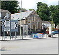
The Citadel, Cymmer Road, Porth
In the middle of the view is a former Salvation Army Citadel (chapel), converted into a 2-bedroom dwelling.
Image: © Jaggery
Taken: 6 May 2011
0.03 miles
2
Ken's Barber Shop, Porth
Open for business as usual?
Image: © Roger Cornfoot
Taken: 25 Apr 2007
0.06 miles
3
Porth War Memorial
Porth War Memorial was rededicated at this site in Porth Square in 2007. The Cenotaph was originally erected in the town centre in 1928 in remembrance of the men of Porth who gave their lives during the Great War (1914-1918). The Memorial had to be relocated to make way for the Porth Relief Road Project. The Memorial seen here has some features not in the original, such as a sentry post inscribed with the names of more than 100 people who were missing from the original.
Image: © Jaggery
Taken: 30 Jul 2014
0.06 miles
4
Caemawr Road, Porth
Image: © Roger Cornfoot
Taken: 25 Apr 2007
0.07 miles
5
Wyndham Constitutional Club, Porth
Viewed along Cymmer Road looking towards the right turn for Caemawr Road.
Image: © Jaggery
Taken: 30 Jul 2014
0.07 miles
6
Ordnance Survey Cut Mark
This OS cut mark can be found on the Wyndham Club, Cymmer Road. It marks a point 97.335m above mean sea level.
Image: © Adrian Dust
Taken: 27 May 2018
0.07 miles
7
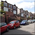
Caemawr Road houses, Porth
Viewed from near the Cymmer Road junction.
Image: © Jaggery
Taken: 30 Jul 2014
0.07 miles
8
Porth Police Station
Located on Porth Street (B4278). The £1.3 million station was built on a site once occupied by the Victorian police station, which had stood for more than a century. The new station was opened in July 2005. Porth is served by the South Wales Police, northern division (Merthyr Tydfil and Rhondda Cynon Taf).
Image: © Jaggery
Taken: 6 May 2011
0.09 miles
9
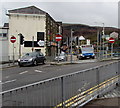
Three No Entry signs, Porth Street, Porth
In March 2020 the Stagecoach bus is on route 150 to Gilfach Goch.
Image: © Jaggery
Taken: 14 Mar 2020
0.09 miles
10
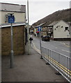
End of cycle route sign, Porth Street, Porth
The sign text is also in Welsh.
Image: © Jaggery
Taken: 14 Mar 2020
0.09 miles


