1
Thai Elephant Oriental Restaurant, Trebanog
On the corner of Trebanog Road and Heol Eurwen Davies, a few metres
on the Trebanog side of the Cymmer (Porth) boundary sign. http://www.geograph.org.uk/photo/4099798
Image: © Jaggery
Taken: 30 Jul 2014
0.03 miles
2
Western boundary sign, Porth (Cymmer)
The A4233 from Trebanog reaches the Cymmer district of Porth.
Image: © Jaggery
Taken: 30 Jul 2014
0.03 miles
3
Ordnance Survey Cut Mark
This OS cut mark can be found on No291 Trebanog Road. It marks a point 164.110m above mean sea level.
Image: © Adrian Dust
Taken: 27 May 2018
0.05 miles
4
Cymer Centre, Cymmer
Image: © John Lord
Taken: 1 Nov 2017
0.08 miles
5
Eastern end of Ton Hywel, Trebanog
This is one of two Ton Hywel/Trebanog Road junctions. The other one http://www.geograph.org.uk/photo/4099657 is about 350 metres away.
Image: © Jaggery
Taken: 30 Jul 2014
0.09 miles
6
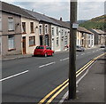
Houses near an old byelaw notice, Trebanog
Viewed across the A4233 Trebanog Road. http://www.geograph.org.uk/photo/4099744 to a closer view of the byelaw notice on the pole.
Image: © Jaggery
Taken: 30 Jul 2014
0.10 miles
7
Ysgol Gyfun Cymer Rhondda, Cymer Centre, Porth
The Cymer Centre (Canolfan Cymer in Welsh) is at the western edge of Ysgol Gyfun Cymer Rhondda (Cymer Rhondda Secondary School), the only Welsh-language secondary school in the Rhondda, with c1,000 students.
Image: © Jaggery
Taken: 30 Jul 2014
0.11 miles
8
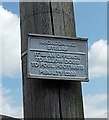
Byelaw notice issued by a now defunct council, Trebanog
Attached to a wooden pole http://www.geograph.org.uk/photo/4099756 alongside the A4233 Trebanog Road, the byelaw notice shows
RHONDDA B.C. (Borough Council). In 1974, the Borough of Rhondda was one of six local government districts of the new county of Mid Glamorgan. The borough was abolished in 1996, with its area passing to the unitary Rhondda Cynon Taf county borough.
Though the council no longer exists, is the stated penalty still applicable?
Image: © Jaggery
Taken: 30 Jul 2014
0.12 miles
9
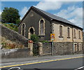
Pisgah Capel y Bedyddwyr, Cymmer
Disused Welsh Baptist chapel.
Image: © John Lord
Taken: 1 Nov 2017
0.13 miles
10
Boarded-up former Pisgah chapel in Cymmer, Porth
Derelict building viewed across the A4233 High Street Cymmer in late July 2014.
This used to be Pisgah Baptist Chapel, built in 1894.
Image: © Jaggery
Taken: 30 Jul 2014
0.14 miles


