1
Ordnance Survey Cut Mark
This OS cut mark can be found on No4 High Street. It marks a point 108.402m above mean sea level.
Image: © Adrian Dust
Taken: 27 May 2018
0.02 miles
2
Footpath from Morrisons Porth to the A4225
Viewed from the NW edge of the Morrisons supermarket site http://www.geograph.org.uk/photo/2472986 on the west bank of the River Rhondda. The sign on the right shows 'No trolleys beyond this point'
Image: © Jaggery
Taken: 6 May 2011
0.03 miles
3
Leith House, Porth
Leith House, Pontypridd Road, houses Cwm Taf Health Board's Dental Teaching Unit.
Image: © Jaggery
Taken: 6 May 2011
0.03 miles
4
Lloyds TSB Porth
Bank branch on the corner of Station Street and Porth Street viewed across the River Rhondda.
The branch's opening hours (May 2011) were 9.30am to 3pm Mondays-Fridays. Closed at weekends.
Image: © Jaggery
Taken: 6 May 2011
0.03 miles
5
Dylan's The Old Post Office, Porth
Viewed across the River Rhondda from the A4225. After being derelict for several years, the former post office building on Porth Street, Porth was transformed in 2009 into Dylan's cafe, bar and steak house.
Image: © Jaggery
Taken: 6 May 2011
0.03 miles
6
Rhondda River downstream from Cymmer Bridge, Porth
Looking SE from Cymmer Bridge, a short bridge connecting the B4278 (on the left) and the A4225. The building nearest the camera is Ken's Barber Shop.
Image: © Jaggery
Taken: 6 May 2011
0.03 miles
7
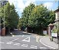
Bronwydd Avenue, Porth
A sign on the corner of High Street points towards council offices in Bronwydd Avenue.
Image: © Jaggery
Taken: 30 Jul 2014
0.03 miles
8
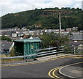
Electricity substation and a hillside view, Porth
The Western Power Distribution electricity substation is located at the edge of High Street.
Image: © Jaggery
Taken: 30 Jul 2014
0.03 miles
9
Recycling area, Morrisons, Porth
The recycling area is at the NW edge of the supermarket's car park. http://www.geograph.org.uk/photo/2472986
Image: © Jaggery
Taken: 6 May 2011
0.04 miles
10
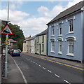
Steep descent ahead, High Street, Cymmer, Porth
The sign shows a 10% (1 in 10) descent ahead.
Image: © Jaggery
Taken: 30 Jul 2014
0.05 miles


