
IMAGES TAKEN NEAR TO
Morgan Street, PORTH, CF39 9AG
Introduction
This page details the photographs taken nearby to Morgan Street, CF39 9AG by members of the Geograph project.
The Geograph project started in 2005 with the aim of publishing, organising and preserving representative images for every square kilometre of Great Britain, Ireland and the Isle of Man.

There are currently over 7.5m images from over14,400 individuals and you can help contribute to the project by visiting https://www.geograph.org.uk
Image Map
Images are licensed for reuse under creativecommons.org/licenses/by-sa/2.0
Notes
- Clicking on the map will re-center to the selected point.
- The higher the marker number, the further away the image location is from the centre of the postcode.
Image Listing (204 Images Found)
Images are licensed for reuse under creativecommons.org/licenses/by-sa/2.0
Image
Details
Distance
1
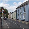
Steep descent ahead, High Street, Cymmer, Porth
The sign shows a 10% (1 in 10) descent ahead.
Image: © Jaggery
Taken: 30 Jul 2014
0.03 miles
2
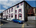
Cymmer Colliery Workingmen's Institute, Cymmer, Porth
Built in Office Street, Cymmer in 1893, enlarged in 1911. The Institute had a hall,
library, reading room, games rooms and committee rooms. Now a social club.
Image: © Jaggery
Taken: 30 Jul 2014
0.03 miles
3
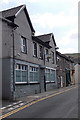
The Pioneer Club, Cymmer, Porth
Viewed across High Street. The sign on the wall shows THE PIONEER CLUB.
The name on the windows is CYMMER PIONEER WORKING MENS CLUB.
Image: © Jaggery
Taken: 30 Jul 2014
0.03 miles
4
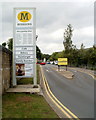
Entrance to Morrisons supermarket car park, Porth
The car park http://www.geograph.org.uk/photo/2472986 occupies about three-quarters of the land at the supermarket site on the west bank of the River Rhondda.
Image: © Jaggery
Taken: 6 May 2011
0.03 miles
5
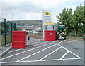
Recycling area, Morrisons, Porth
The recycling area is at the NW edge of the supermarket's car park. http://www.geograph.org.uk/photo/2472986
Image: © Jaggery
Taken: 6 May 2011
0.03 miles
6
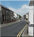
Between School Street and Office Street, Cymmer, Porth
Looking along High Street from the corner of School Street.
The Office Street junction is in the distance on the right.
Image: © Jaggery
Taken: 30 Jul 2014
0.04 miles
7
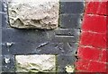
Ordnance Survey Cut Mark
This OS cut mark can be found on No4 High Street. It marks a point 108.402m above mean sea level.
Image: © Adrian Dust
Taken: 27 May 2018
0.06 miles
8
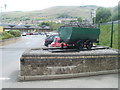
Cymmer colliery memorial, Porth
A colliery coal truck is mounted on a brick plinth at the western edge of the car park at Morrisons supermarket in Porth. The inscription on the plinth records
CYMMER COLLIERY
IN MEMORY OF THE 114 MINERS WHO LOST THEIR
LIVES ON THIS SITE ON 15TH JULY 1856.
AND TO THOSE MANY OTHERS WHO SIMILARLY
PERISHED IN THE RHONDDA COALFIELD.
The memorial was dedicated by the Rt. Hon. Viscount Tonypandy on November 6th 1988.
Image: © Jaggery
Taken: 6 May 2011
0.06 miles
9
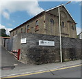
Former Cymmer Congregational Chapel, Porth
Now part of the R.A.Hulland premises in High Street.
http://www.geograph.org.uk/photo/4100305 to a view of the east side of the former chapel.
Image: © Jaggery
Taken: 30 Jul 2014
0.07 miles
10
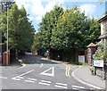
Bronwydd Avenue, Porth
A sign on the corner of High Street points towards council offices in Bronwydd Avenue.
Image: © Jaggery
Taken: 30 Jul 2014
0.07 miles